Last Updated on 19th October 2023
In 2020 and the country was locked down due to the Coronavirus pandemic. The easing of restrictions towards the end of May permitted us to venture out a bit further from home for our exercise. What with the stunning weather we were enjoying, what a great opportunity to seek out the scenery and beautiful beaches on a walk around Trevose Head.
Trevose Head
The mass of headland that extends north of Porthcothan to Harlyn is known as Trevose Head. At its most northerly point in Trevose Head Lighthouse. The headland is home to some of the best beaches in Cornwall and a magnet for both locals and visitors.
There are many places to holiday or take a short break in this area. Besides the local delights, it would make a great base to visit other places and attractions in Cornwall. As well as some of the places I mention below, here is a list of hotels and holiday properties in the St Mawgan and Trevose Head areas.
Harlyn Bay
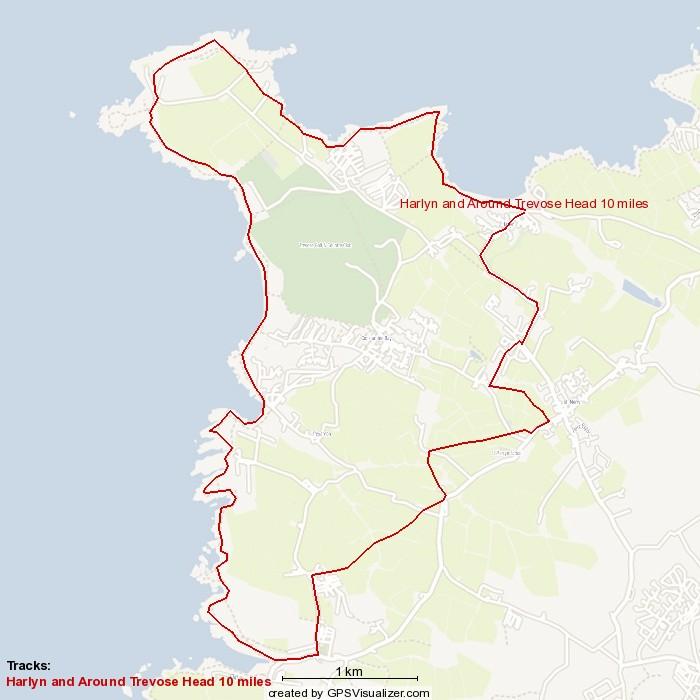
My son and his partner enjoy surfing, so we agreed on Harlyn Bay where I dropped them off and parked the car. I’m amazed that I found a spot on the front row looking over the beach. There was an honesty box at the entrance of the car park – £3 for the day. I didn’t have change so put in a fiver. I set off on my planned ten-mile walk – clockwise around the Trevose headland.
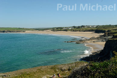
Harlyn Bay is just gorgeous, Beautiful golden sands stretch out into the turquoise seas beyond wave after wave of a surfer’s dream. It’s a great beach for families, novice surfers and for mooching around its rocky coves. There are toilers by the car park.
On with the Walk around Trevose Head

This is a 10-mile walk with a few challenging hilly parts but, on the whole, it’s quite tame. Download the GPX file for the route shown above. Beware, it contains warts and all where I veered off-piste to investigate, take photos, or I simply took the wrong path.
Harlyn to St Meryn to Porthcothan Bay
For the first part of the walk, head up the road, through Harlyn Village to St Meryn. There are lots of shops and a few cafes and pubs. Pick up any snacks and drinks for walking fuel.
From St Meryn, head out on the SW road and then choose to walk the lanes and cross-field public footpaths. I say choose because the footpaths are marked by the Ordnance Survey maps as lying diagonally across the fields. It’s so annoying that farmers plant the fields such that the footpath cannot be detected. So, walking the perimeter of a field might seem logical, but it is not a public footpath. Also, it’s actually shorter to stay on the road in some places, rather than walking the field perimeters. Farmers should note that we walkers might do more damage to crops in trying to find the rightful public footpath. Make the paths obvious!
After approximately 4 miles of walking across the headland, you come out onto the road going into Porthcothan Bay to pick up the South West Coast Path.
On my visit, I was lucky that the weather conditions – a fresh breeze with a SE wind – produced a beautiful day for photography. Clear visibility, lively seas and vibrant colours. The effects of lockdown were obvious. There were very few people about on that Public Holiday Monday. Let’s hope the officials have learnt that lockdowns do more damage than good for people’s mental and health well-being.
Venture up the Coastpath there is a bench that overlooks Porthcothan Bay. For me, it was out with the camera while sipping a great coffee from my flask, complemented by a couple of biscuits, of course!
Porthcothan to Treyarnon
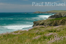
Back on with the walk to head North on the coast path to Treyarnon on the east side of Trevose Head. As the coast path clears Porthcothan and gains height, the stunning seascape views soon emerge. I found it difficult to make much progress with walking. The shutter count on my camera certainly got a pounding though.
What’s amazing about this stretch of the coast path is how it weaves and wends its way, high, around the rugged coves. Each turn of the path opened up a fantastic photo opportunity.
A search and rescue helicopter made a number of appearances with a long fly-pass along the coast. I started thinking that something was wrong.
The coast path continues on to the south of Treyarnon Beach, which was absolutely beautiful. It was at this point that I passed the Coastguard and Police vehicles and I noticed the lifeboat out in Booby’s Bay take off at a rapid pace. A cold shiver went down my back.
Treyarnon to Constantine Bay
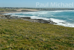
Continue the walk, north along the Trevose Head coast path onto Constantine Bay. The coast path is routed along this amazing beach with its stretch of sand dunes.
The sands are deep, dry and light-golden, and can be hard going when walking with boots. Again, it’s a personal choice time. I chose to go up into the dunes, which have a network of walkways. At around halfway along the beach, though, these paths veer off in the wrong direction. So I headed down a steep dune to beach level and carried on walking onto a wooden stairway back up to the car park.
Constantine to Booby’s Bay & Trevose Lighthouse
I know what you are thinking, and I have no idea why. All I know is that Booby’s Bay is really like an extension of Constantine, and so the beauty of the area just goes on and on.
To the north of Booby’s Bay, the path takes to the cliffs again for more rugged seascapes. Trevose Lighthouse comes into view and then disappears behind a landmass. Eventually, after the last steep section, the path reaches the National Trust car park at Trevose Head. The coast path goes right by the lighthouse and then heads away to the NE to walk around Trevose Head.
Trevose Lighthouse to Mother Ivy’s Bay
A little further on, the path swings round to the SE. Take in the view over Mother Ivy’s Bay with Harlyn beyond. It’s very impressive!
Mother Ivy’s Bay is really impressive. As the path nears the Bay, the RNLI Lifeboat Station can be seen below. The path hugs the top of the beach and rocks. As you look back you can see the lifeboat station as a backdrop to this fantastic stretch of the coast.
There has been a campsite here since as far back as I can remember. As a young lad, my family would visit my Aunt and Uncle who used to stay here in a small caravan in the early 1970s. It’s more of a holiday park nowadays with static caravans and camping facilities.
Mother Ivy’s to Harlyn Bay
The coast path continues and curves around Mother Ivy’s and then heads west out on a landmass that juts out between Mother Ivy’s and Harlyn Bays. It overlooks Big Guns Cove.
Now on the home straight and Harlyn Beach and car park come into view. The path continues along Harlyn Beach, but around halfway along, the coast path heads off in a different direction. I took the path down to the beach to complete the walk.
I didn’t have to walk for too long before I was greeted by my son and his partner. Time for a well-earned swim. Clothes off, cozzies on and, within no time, I’m in the water. It’s been a fantastic day and easily worth the fiver I paid at the car park.
If you would like to get into hiking or walks, read my article, A Beginner’s Guide to Hiking and Walks.
Sad News
Sadly, I learned later, it wasn’t a good day for the poor chap who lost his life out at sea. The lifeboat that I saw had got him on board, but he died soon afterwards. It’s a grim reminder of the perils of going into the water. It’s so sad for the family he left behind.
The RNLI lifeguards are there for a reason, so please look at the notices and heed their warnings and suggestions. What looks beautiful has hidden dangers.
Thanks for reading about my walk around Trevose Head. Comment below if you have walked this area or want to know more information. Also, follow me on social media to see my regular updates.


