Last Updated on 19th October 2023
This is a fairly challenging 13.5-mile circular walk that starts in St Germans, Cornwall. The route heads out to the coast to Seaton via a section of the Seaton Vally. From Seaton, it’s along the beach to Downderry and then the SW Coast path to Portwrinkle. From Portwrinkle, it’s back inland to St Germans.
This hike can be shortened if you are able to get a lift or do some of it by public transport. I plotted and started walking this route in between the COVID lockdowns. I’ve done all of it a few times – both directions. I’ve also arranged to be picked up by my wife a number of times. Especially in the winter months when there simply aren’t enough daylight hours on a winter’s afternoon.
Getting to St Germans
If you don’t live in the area, St Germans is on the mainline train service. You can get to St Germans direct from locations like London, Bristol, Exeter, and Plymouth. Also from West Cornwall – Penzance, Truro, St Austell, Bodmin and Liskeard. There are a few buses, but not as frequent as the trains.
St Germans, as well as the places along this route and nearby, make for a great holiday break. Take a look at these hotels and holiday properties in the St Germans area.
The Route
Here is the route. It has plenty of hilly challenges and you should allow 6 hours to do all of it with stops along the way.
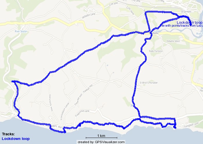
It comprises roads, lanes and a short footpath for the first 5.5 miles to Seaton – more exercise than scenic – but you might meet a few people cycling and running along the way. Note, this route was traced from my front door.
From the north side of the station at St Germans, where the station road meets the main road through the village, turn left and immediately left again. This road rises up to a track that heads off over Longfields. At the crossroads at the end, turn left down the lane to Polbathic.
Nearing Polbathic you can turn right to walk down the lane to the car repair garage or down to the main road and cross over to walk right (west) along the roadside walkway. From the garage, you cross and walk along the same walkway. Walk on to the left fork, signposted Narkurs.
This road is a long incline, steep in places. It leads up to a crossroads just outside of Narkurs village. Carry straight on and, after another half-mile, you come to a signposted public footpath. This is a steep path down to Seaton Vally.
Seaton
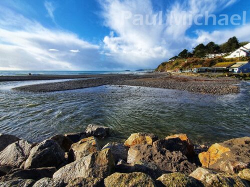
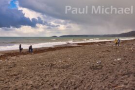
Not to be confused with the one in Devon, this Seaton is a seaside village with a beach, bars and cafes/restaurants. The river Seaton runs down through Seaton Vally, which is where the route joins, around half a mile from the seafront. As you near the seafront, there is a snack shack I often use to grab a coffee and a snack to enjoy on the beachfront, people-watching. It may be closed over the winter months, but there are other cafes here.
Into Seaton, walk left along the through-road and then take to the beach entrance to walk along the coastal defence wall into Downderry. The views over the coast are fantastic.
Note: if the tide is high, do not take this route. Instead, follow the coast road east to rise up to Downderry.
Downderry
Somewhere along the wall, Seaton merges into Downderry. The wall comes to an end after about a quarter of a mile, and you walk down the concrete steps to the beach. If you headed my warning above, you won’t be cut off by the tide!
Downderry has plenty of holiday properties, along with restaurants and a lovely pub, the Inn on the Shore. As you walk along the beach, you can walk up the steps to the pub. If not, carry on and turn up to the coast road by the school. There is a stream outfall by the school that might not be noticeable in the height of summer. Walk over the stream and then up the steps, along a footpath to the road.
Continue walking east along the road and out of Downderry. You come to a sweeping bend in the road and the signposted SW Coast Path to Portwrinkle.
SW Coast Path
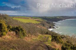
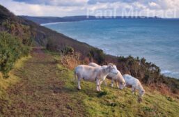
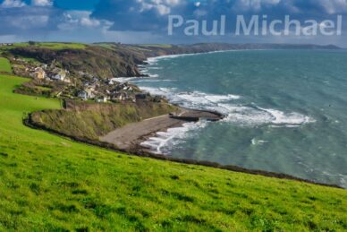
It’s a fair old hike to Portwrinkle. The first section of the coast path snakes vertically up the cliff, and so you feel you aren’t getting anywhere fast. It levels out a bit, but there are a number of undulations and steps along the way.
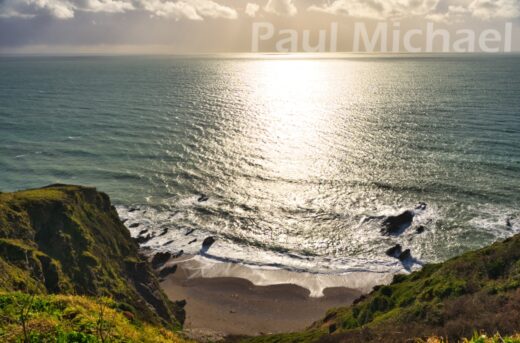
As I ascended up the path, the coast came into view. On this occasion, it was much better than I had imagined it would be. Quite stunning, in fact, with turbulent seas and an amazing stormy sky as a backdrop.
Around half a mile or so along the coast path is St Germans Hut. This is a dilapidated building that once served as a team room for the guest of the Earl of St Germans. They would be transported here by horse and carriage for a day at the seaside and afternoon tea.
When the weather had been particularly wet, the coastal path presents a number of slippery issues to cope with. It’s not so bad going up the slopes and hills, but going downhill can be very treacherous. You can also get caught out easily, just when you think all is well, you can get an unexpected sidewinder slider and your feet can be swept from under you.
What goes up eventually goes back down, and down, to Portwrinkle.
Portwrinkle
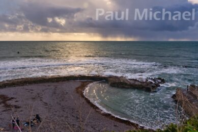
The SW Coast Path ends at a gate onto a lane leading down to the seafront at Portrinkle Harbour and a beach. I love this little harbour and have spent many hours there with family and friends, or on my own, watching the tide come in or go out. It’s a great place to stop for a bite to each and refreshments. There is also a more sheltered bench a little further down the road if the weather is too bad.
Continue walking along the coast road. There are good views over the wall to the beach below. As you approach the Jolly Roger cafe building at the head of the car park, the beach below is Finnygook Beach.
It’s now time to leave the coast and head inland. The route is left as you come out of Portwrinkle. You’ll see the Golf Club building on the left. Walk up to it and around to the left. You’ll see a parting and the public footpath on the steep incline up the hill. If the weather is too bad I have stayed on the road up to Crafthole once or twice.
Continue up the footpath. It crosses a section of the golf club and has bells there so you can warn the golfers of your presence. They haven’t been maintained, though, so they no longer work.
The path crosses over a road and then wends its way to Ambler’s Walk. This is a permissive path that runs alongside the Crafthole road. It’s very welcome too, as that road can be quite dangerous.
Polbathic
At the bottom of Ambler’s Walk, pick up with the lane that leads back up the hill – as if you haven’t endured enough hills already!
The lane levels off and then back down the other side. There’s a lovely old oak tree halfway down on the left. Eventually, the lane comes out onto the main road.
Beware: the main road is anything but safe. Despite the 30MPH signs, very few drivers observe that rule and there is no proper pavement – just faded painted lines.
I often end this walk and stop in the Halfway House at Polbathic for a well-deserved drink. I arrange a lift up the road from my wife.
It’s just 1 mile to St Germans going straight up the road.
If you would like to get into walking, read my article: A Beginner’s Guide to Hiking and Walks.

