Last Updated on 19th October 2023
London is such an exciting and vibrant city to visit at any time of the year. There is so much to see and do that it can be overwhelming to the visitor. So, take it easy with my guided 10-mile walk around London’s West End. The walk starts in central London and then heads as far west as Kensington Palace. It then circles around, back into West End theatre land. Walk all of it or part of it, in either direction. Being a circular walk, there are many options.

Click to download this map.
Seeing the London sights on foot is a great way to explore. You see things that you would likely miss on a tour, bus, car or, worse, on the underground!
If you are looking to visit London, take a look at these great places to stay in the Capital. From my experience, if you can get a deal in central London, that’s great. You may get better deals by looking further out. With buses and overground/underground trains, you are typically within 30 minutes of getting anywhere in the city. Often, you can get places with no congestion charges and free parking, which may be an added bonus. Take a look at these listed deals, or click to see all the deals…
Take a look at these fantastic books on London. These make great travel companions and give you more background and insight into the places on this route. They also provide ideas on places to visit and things to do for your London adventure.
London – Explore on Foot
I was born in London, and my grandparents managed a couple of pubs in different areas. I wanted to incorporate one of these locations, as well as the more common visitor places, into a worthy walk.
It starts at Fleet Street because that’s where I dropped my wife off for her writing course. You could start and end this walk anywhere along the route, but I have written this guide as though walking clockwise from Fleet Street.
Fleet Street
Famous for being home to the British press, it got its name from the river it crossed. The river was filled in, but the buildings of the tabloid and book printers are very impressive. Some date from the 1500s. It is also home to the magazine, The People’s Friend, which is the longest-running women’s weekly magazine in the world. They (DCT Media) were the host of the writing course my wife was attending.
Fleet Street can be reached by overground, underground, taxi or bus from anywhere in London or Greater London.
Walk east along Fleet Street to New Bridge Street and turn right, heading south to the River Thames and Black Friars Bridge.
Blackfriars Bridge
The bridge you see today was opened by Queen Victoria in 1863. It replaced a bridge built in the 1700s of Portland stone but, due to bad workmanship, was not cost-effective to repair and was instead demolished.
Joseph Cubitt designed the white and red trimmed, multi-arched bridge. Although also demolished, there was once an adjacent railway bridge by the same designer who met the requirement that the wrought iron arches be aligned. A tram line ran over the bridge from 1909 to 1962.
Continue south to Blackfriars Road.
South Bank
Once over the bridge, you have a choice to walk east either along the river or, as I did, along Stamford Street. I’ve had plenty of visits to London and was more interested in the buildings than the river.
South Bank is home to the National Theatre and the BFI Film Theatre. It’s an arts centre for London and there are restaurants and trendy bars along the streets and riverside. You’ll see Parliament, Big Ben, and the London Eye from the riverside.
You’ll also come across King’s College London Campus and Waterloo Station.
At the end of Stamford Street is the impressive BFI Film Theatre. It’s a round building set as a roundabout. From here, head right along Concert Hall Approach and then left along Belvedere Road. Take this route or continue along the riverside to pass Jubilee Park and the London Eye. You need to book this in advance if you wish to combine this with your walk.
Pass by Waterloo Bridge, and Hungerford Bridge to get to Westminster Bridge.
Westminster Bridge
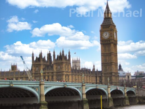
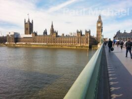
This is the bridge you often see in pictures and videos for news bulletins any time there is a story about the government.
There has been a bridge at this site since 1750. If plans hadn’t been so opposed, it would have been built much earlier. The original bridge of the 1700s proved too costly to maintain and so was replaced by the bridge you see today in 1882. It was designed by Thomas Page and is a traffic and pedestrian crossing.
Due to London Bridge being removed in 1962, Westminster Bridge is now the oldest Thames road crossing in central London.
The bridge of 7 wrought iron arches is mostly painted in a shade of green. Some say it’s the colour of the seats in the House of Commons, just a stone’s throw in behind the Palace of Westminster. For me, it is a similar shade to a copper/bronze statue. Although they say, Lambeth Bridge is painted red – as with the seats of the House of Lords, further south down the river.
As you walk over, you can’t help but be drawn in by the architecture and splendour of Parliament, Big Ben and the Palace of Westminster. Keep to the right of the bridge as you cross if you want to visit the Cenotaph memorial along Parliament Square.
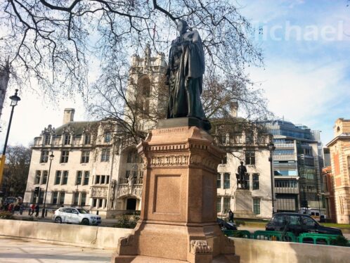
Just over the bridge, there is the statue of Benjamin Disraeli, the 1st Earl of Beaconsfield and Conservative Prime Minister.
Spend a little time around this area, as there is so much to see. When you are done, continue east along Great George Street and then Birdcage Walk to St Jame’s Park.
Birdcage Walk & St Jame’s Park
As you turn into Brisdcage Walk, there is the Queen’s (maybe the King’s now) Gallery and Buckingham Palace to the west, and St Jame’s Park is all along its north side.
Birdcage Walk is named so because King James I, after whom the Park is named, loved exotic birds. He had caged birds and aviaries lining the walk to the palace.
The route enters the Park about halfway along Birdcage Walk. Head north into the Park and over the bridge that crosses St James’s Park Lake.
As you cross the bridge, look east over the lake to see a quaint cottage on the lake shores. This is Duck Island Cottage and was built in 1837 by the Ornithological Society of London. The flora of the island itself simply masks the pumps and filtration gear needed for the lake and its water fountain.
Continue walking north and out of the Park to the Mall.
The Mall, Buckingham Palace & the Memorial
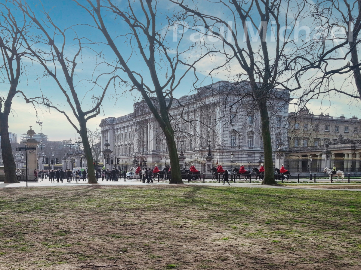
The route crosses the Mall at a central point. There at the end, of course, is Buckingham Palace in all its splendour. It is such an iconic location with a tree-lined straight approach. It’s what you see in just about any royal ceremony TV coverage.
At the other end is Trafalgar Square, home to the statue of Trafalgar, water fountains and thousands of pigeons.
The route continues north to walk around St Jame’s Palace. This was home to Enland’s kings and queens up until the reign of Queen Victoria. It is now used primarily to house members of the royal family and to provide staterooms and accommodation for official visits and functions. Most of what you see was built by 1536, as commissioned by Henty VIII. So you see Tudor architecture in royal style.
Walk anti-clockwise around the palace to emerge back on the Mall. Then walk towards Buckingham Palace to Queen Victoria’s Memorial. It marks the death of Queen Victoria in 1901 and was unveiled after its completion in 1911 by King George V. The smaller statues around its base represent courage, constancy, victory, charity, truth and motherhood.
Behind the memorial is Buckingham Palace, which is the official royal residence of His Majesty the King. It was originally named Buckingham House (some London locals often refer to it as ‘Buck House’). Originally, it was built for the Duke of Buckingham in 1703 and was bought later in the 1700s by George III for Queen Charlotte’s private residence. In the 1800s it was extended and then, in 1837, it became the official residence of the British monarch and Queen Victoria.
I was lucky to see the Horseguards riding onto the Mall while I was there.
Walk on to Constitution Hill toward Wellington Arch.
Constitution Hill, Wellington & Memorial Gates
Constitution Hill runs from the Mall, west to Wellington Arch, with Green Park to the north and Buckingham Palace Garden to the south. The origin of the name is uncertain but may be a reference to King Charles II taking ‘constitutional’ walks. It was mentioned as Constitution Hill in Parliamentary papers from 1642.
The Hill was a popular place for duals over the years, but not a great location for Queen Victoria – three attempts to assassinate her took place here during the 1840s.
The Wellington Arch, designed by Decimus Burton, was completed in 1828.
Further along the route, by Hyde Park Corner, is the more recently built Memorial Gates that pay tribute to the lost lives of 5 million + soldiers of the Commonwealth.
From Hyde Park Corner, enter the Park and walk along the ENE route.
Hyde Park & Kensington Gardens
I’ve been to Hyde Park on many occasions. In recent years Winter Wonderland has been one of the main reasons. It was only when doing this section of the walk that I realised the enormity of the Park.
You could do a walk around the Park on its own. Take the tube to Hyde Park Corner and do a loop around.
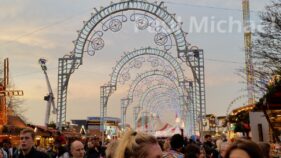
Taking the ENE path takes you past the Winter Wonderland site. It started in 2005, but success came in 2010 after the inclusion of an ice rink, giant wheel and other rides, plus the Bavarian Village. It has been further expanded over the years and, although cancelled in 2020 due to COVID restrictions, it is a major London attraction.
The Serpentine
Walk until you reach the NE corner of the Serpentine, and then walk SW along its head and pick up with the path that hugs its south side.
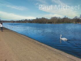
The Serpentine was created in 1730 for Queen Caroline. Its name was given to its snakelike bends and curves. The name is actually given to the eastern section of the lake up to the Serpentine Bridge. After the bridge, The lake is known as The Long Water and Hyde Park becomes Kensington Gardens.
The Great Exhibition of 1851 was held here and, more recently, the 2012 Olympics used the lake for the triathlon swimming event. Nearer to the bridge is the Serpentine Lido. They organise regular swimming events on the lake.
A little further along the is the Princess Diana Memorial water fountain of 2004. Sections of it were built from Cornish granite.
Prince Albert
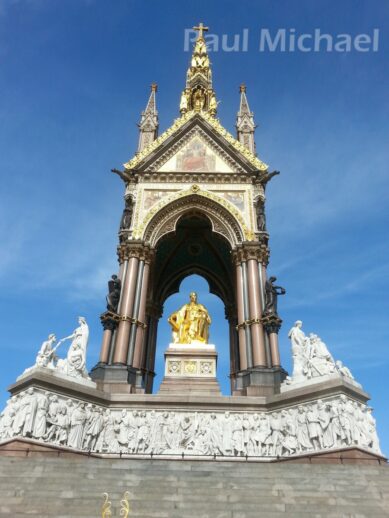
Upon reaching the bridge, the route takes a diversion, first SW and then south, to take in the Albert Memorial and the Royal Albert Hall. Prince Albert died of Typhoid in 1861 and a memorial was unveiled 11 years later. It shows Prince Albert holding a catalogue of the Great Exhibition, for which he had a major influence.
Just a short walk along Kensington Gore, turn back into Kensington Gardens by the Gorilla Circus Flying Trapeze School. Maybe keep a look out!
Kensington Palace
Pick up with the path heading NW to Kensington Palace and the Round Pond.
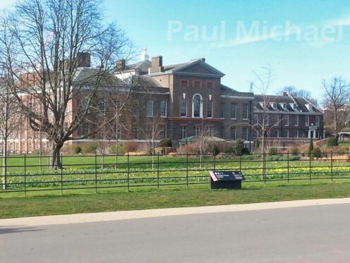
Kensington palace was the birthplace of Queen Victoria and home to successions of royals for over 300 years. There is a statue of Queen Victoria at the front of the Palace. Today it is the official residence of the Prince and Princess of Wales. When I did this walk last, I associated it with Princess Diana, but now her eldest son, William, and his wife, Catherine, are in residence.
The Palace was built in 1605 and became a royal residence for King William III in his search for a palatial home away from the damp, foggy air that played on his asthma condition. The palace was completely re-structured by Sir Christopher Wren to make the residence more appropriate as a royal household.
The Round Pond was created in 1730. It’s not as round as its name suggests and is 150m by 200m in size. It is 5m deep in parts. The pond is a big hit with model boat enthusiasts and has been the home of the Model Yacht Association, founded in 1876. As well as model boats, you’ll see swans, ducks and geese bobbing along.
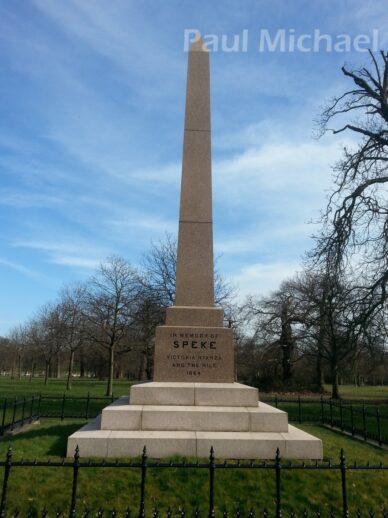
At the 11 O’Clock point of the Round Pond, take the NE path and walk towards Lancaster Gate and the head of the Long Water. The monument to John Hemming Speke is along the way. He was the first European to lead expeditions along the Nile.
Walk over West Carriage Drive and, towards Victoria Gate, pick up with the Park path that heads east alongside Bayswater Road.
Speaker’s Corner & Marble Arch
Bayswater Road becomes Hyde Park Place. Just before getting to the end of the path, walk out onto the road and pavement. On the corner, cross the road to see Marble Arch and its Fountains. The Arch was designed in 1827 by John Nash and was erected at the front of Buckingham Palace originally. It was the grand entrance of the guardsmen. It was later moved to its present site.
Walk back into Hyde Park, heading SE along Park Lane to come across Speaker’s Corner. Hyde Park has long been a venue of protests, and an act of parliament in 1872 set aside this corner for public speaking.
Tyburn Gallows was in operation up until the late 1700s. It is thought that ‘free speech’ came as a right of the condemned to have their final words before their death. Tyburn is not far from Speaker’s Corner but, due to crowd control issues (it was a good day out to watch people being hanged), the gallows were moved elsewhere before Speaker’s Corner became the go-to place.
You can still see and listen to speakers on a Sunday morning.
Continue down Park Lane and take the second left to Upper Grosvenor Street.
Mayfair
This is the most lucrative area on the Monopoly board. I hadn’t realised quite where I was by this point. I came across an obviously very wealthy family arriving at one of the top hotels in the area. Out came all the uniformed porters and the hotel manager to greet them and handle their luggage. There was me in casual walking attire and looking a bit sweaty by now. I got a few looks as if to say, ‘please move on’.
The route passes by Grosvenor Gardens. As well as grade II listed Grosvenor Gardens House, there is also a memorial to the Rifle Brigade for their part in the first and second world wars.
Continue walking along Grosvenor Street. The route crosses New Bond Street, and further on, St George’s Street. It then takes a NE direction on Maddox Street.
Soho
We are now in theatre land and the heart of London for shopping. During the 60s and 70s, Soho was quite a seedy area of London with lots of sex shows and such. I guess there are some still around but, on the whole, Soho feels much safer nowadays. It is vibrant and trendy and, clearly, a very popular destination.
Liberty
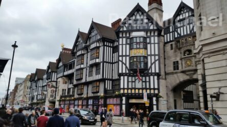
The route enters Soho along Great Marlborough Street. Liberty is about 100m along on the right. If you have time to go in it is worth a look. Arthur Lasenby Liberty founded the store in 1875 having borrowed money from his father-in-law and taking a building in Regent Street. The building you see here was constructed from the timbers of battleships, HMS Impregnable and HMS Hindustan, in 1922. If you want a building to look much older than it actually is, that’s how you do it.
Continue walking to Noel Street and then turn left at Poland Street.
There were a few cafes along Poland Street where I didn’t feel out of place with what I was wearing. That was good for me as I was quite hungry. I went into a small family-run business who were very welcoming. The food and refreshments were great, and the prices were quite sensible too. What I hadn’t realised is how close to Oxford Street I was – just at the end of the road. So it goes to show that you can find great service and prices off of Oxford Street.
Oxford Street
Just a few steps up Poland Street is Oxford Street. Right in the thick of shopper-land, you have noise, the hustle-bustle, traffic and all the flagship stores. It is Europe’s business shopping street and sees some 500,000 visitors to its 300+ shops each day!
I talked about Tyburn Gallows above. Well, Oxford Street was originally named Tyburn Road. It changed during the 1800s when merchants and traders became attracted to it to sell their wares.
Soho Square Gardens
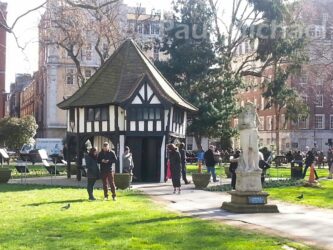
Further east along Oxford street, where two lanes reduce to one, on the right is Soho Street, leading to Soho Square Gardens. This is a fascinating area. The gardens were once named King Square (Charles II) but by the mid-1700s Soho Square was the recorded name. It was once the most fashionable area to live in London.
The statue of King Charles II was put in place in 1681. It moved from a centrepiece to where you see it today some time since then.
The timber-framed building you see in the centre is actually an electricity substation. The mock-Tudor building, built in 1926, does a great job of hiding it.
Walk south out of the Square, down Greek Street and left onto Mannette Street. This leads to Charing Cross Road.
Denmark Street
A short walk up Charing Cross Road gets to Denmark Street.
As a keen guitarist, Denmark street was not to be missed. There are umpteen musical instrument shops along this short street, mostly guitars. After I drooled over the wonderful offerings, I continued around to the east and onto St Giles High Street.
West End & St Giles
All of this area in St Giles is West End theatre land. It’s where many top shows start and are watched by the masses year after year.
Shaftesbury Theatre & The Oporto
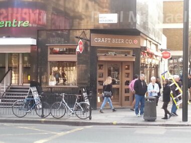
Another reason I took a route was for the rather unnoticeable pub at the end of the Oasis Sports Centre at the junction of Shaftesbury Avenue, High Holborn and the famous Shaftesbury Theatre. This little pub was once named the Oporto and, back in the 60s, it retained an old pub-looking architecture on the end of the rather modern facade of the sports building. In recent years, the design of the Oasis Sports Centre has extended over its upper floors and there is just the angled doorway into what is now called the Craft Beer Co.
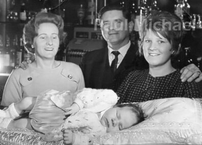
The Oporto was managed by my grandparents at the time I was born. You see me on the bar in the photo below – not much has changed!
It was frequented by the big stars of that time like Warren Berlinger, Ronnie Corbet, Barbara Windsor and, in particular, the magician, David Nixon (who often guested at the Palladium up the road). He was the top magician during the 60s and, according to my parents, he frequented the Oporto when he was in the area. Here is David Nixon in a live show at the Palladium from 1965. Old film, but great tricks.
Shaftesbury Theatre, originally the Princes’ Theatre, opened in 1911. It was renamed in 1962 and had a succession of long-running shows, including Hair from 1968. So good was that production that it raised the roof in the 70s – well, more like part of the ceiling collapsed! Maybe the production was just a tad too saucy.
With that bit of nostalgia out of the way, walk SW back down Shaftesbury Avenue. After a short while, take the left fork, south, along Monmouth Street.
The Seven Dials
This part of London has survived since Tudor times. The design from the 1690s had 6 roads converging. A seventh was added later. The column in the middle is a 6-faced sundial. The column itself is said to be the seventh.
The designer hoped to attract the wealthy and nobility, but that was not to be. This area was once the notorious slum area of St Giles. Filthy and disease-ridden. Charles Dickens, John Keats and others wrote of this area.
Thankfully, it is much more cheerful today. There are plaques around from which you can learn how to tell the time from the sundials – if the sun is out.
Continue walking south along Monmouth Street which merges into Upper St Martin’s Lane. At the next major junction walk SE along Garrick Street.
Covent Garden
A little further and around Garrick Street is Covent Garden. This was a former fruit and veg market that prior to that time, dating back to the 1200s, was known as the Garden of the Convent (Westminster Abby).
After the dissolution of the monasteries, designers went to work on the area and an Italian-styled square was developed. This brought in wealthy and fashionable people but, gradually, its appeal reduced and it was known more for its brothels.
During the 1800s the iron roof cover you see today was erected to try and secure the market and keep the less desirables at bay. This worked but, into the 1970s, it caused major traffic issues. The original market was moved elsewhere and named New Covent Garden, but the original buildings remained to become what is now a central entertainment and cultural hub in London’s West End.
Walk through Covent Garden and, after a good look around, out through the other end to Russell Street. This leads to Drury Lane.
The Strand
Another wealthy area of London on the Monopoly board is The Strand. Its name simply means the edge of a river. This particular Strand has many beautiful hotels and is considered part of the West End for theatregoers and show lovers.
It has been popular with the wealthy and nobles since the 12th century. They built their mansions and palaces between the Strand and the river up until the 1700s.
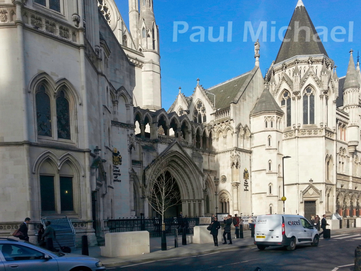
As you approach from Drury Lane, turn left onto Aldwych. Continue around this arced route to the Strand. As you walk east, you will see the Royal Courts of Justice. The architecture of this building and its most amazing entrance is stunning.
Continue east along the Strand to merge back into Fleet Street where this walk around London started.
End of the walk
I hope you get to experience this walk, or maybe a part of it. I really enjoyed it, not just for my own nostalgic reasons, but because I discovered a great deal that I have learnt about in writing this guide.
Please leave your comments below. I would love your feedback, especially if you take up this walk.


Thanks so much for that. I will do the walk but in maybe 3 parts. I’m also a Londoner, living in S London now, but born in East London. So I’m lucky enough to get my London Freedom pass, so I won’t have to pay for my journey!
Is it possible for me download the map?
Thanks
Hi Judith. Yes, I have just updated the article and put a link just under the map so that you can view it on a separate tab. From there you can download it, print it, or whatever works best for you 🙂 Many thanks