Last Updated on 19th October 2023
Walking in SE Cornwall from my doorstep in St Germans out to the South West Coast Path to Seaton, Downderry, Portwrinkle. Then west to Milendreath and Looe. Or further east to Tregantle, Whitsand Bay, Rame Head, Penlee Point, Cawsand, Kingsand Cremyll and Mount Edgecumbe. My walks are mostly circular and include the inland villages of Polbathic, Narkurs, Millbrook, St John and Antony.
Living in SE Cornwall, I get to walk in this area more frequently than any other. It’s so easy to take it all for granted but, when I’m out and about, I get the opportunity to appreciate my surroundings. No walk is the same, even if it’s the same route. The surroundings change quite dramatically with the seasons and weather conditions. I never get bored walking in SE Cornwall.
Take a look at these great books and guided walks for South East Cornwall. They make good walking companions.
St Germans
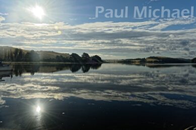
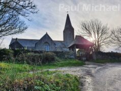
I live in St Germans, which is just about 9 miles from the major SE Cornwall towns around it – Saltash, Liskeard, Looe and Torpoint. It’s a beautiful village with a great heritage. We have Port Eliot, the home of the Eliot family, along with an important and historic Priory, the Eliot Arms pub, Scholars Restaurant, Reciprocity gift shop & cafe and the all-important community shop. The viaduct and river are pretty spectacular when the lighting is good too.
There is a railway station on the main line in and out of Cornwall. Something to consider if you wish to visit St Germans and take up any of the walks.
St Germans would make a great base for a holiday or short break in Cornwall. Here is a list of holiday properties in and around St Germans. Some of these are located on the routes I describe below.
Walking in SE Cornwall
What follows is about my walks in the local area that take in a good chunk of SE Cornwall. There is a great deal more to discover west of Looe, although I have written about my Polperro, Lansallos and Polruan walk.
Although there are a few circular walks from St Germans, I often organise them so that my wife can drop me off or pick me up at the start or end of the day, dependent upon how this best fits in with what she is doing. My hikes incorporate both inland lanes and footpaths, along with the South West Coast Path. From my doorstep, I can get to the Coast Path at Portwrinkle in just under 4 miles, or Seaton in just over 5 miles.
Coronavirus
The Coronavirus pandemic and lockdown rules that came into force in March 2020 made getting out and about quite difficult. We could exercise but weren’t allowed to travel to get it. This was great for me. Especially when the government advised that we could take in more exercise – not limited to within an hour. Times like these make me realise how very fortunate I am with so much near to my doorstep. Walking in my area helped me to discover so much more about my surroundings in SE Cornwall.
St Germans to Seaton
St Germans to Seaton is just over 5 miles and is mainly of roads and lanes. It starts from St Germans to Polbathic. I usually walk up to Longfields, an area of land atop St Germans, and then down, to keep off of the road. From Polbathic, it’s west along the main road and then take the lane up to Narkurs and on to Seaton. There’s a public footpath about a mile after Narkurs that leads down to the Seaton Valley Country Park. This leads out to the main beach road.
In the winter I head to the beach to find somewhere to have a flask-served coffee, as many of the outlets are closed out of season. There are some lovely cafes, pubs and restaurants at Seaton. When they are open, I like to take advantage of local businesses and be amongst the many visitors with a coffee and delicious cake.
Seaton is a relatively quiet seaside village that attracts many holidaymakers. The River Seaton runs down through the Country Park and swerves out through the beach to the sea. I love walking in this area, it’s a wonderful slice of SE Cornwall all year round.
Seaton and Downderry offer some fabulous holiday properties for all-year-round short breaks and vacations.
Seaton to Downderry
On with the walk, which takes the beach sea defence walkway to Downderry. At the end walk, there are steps down to the beach to continue onto the slipway and up to the road. There’s another way up a bit further on, by the school, that I sometimes use. If the tide is low, as with spring tides, it’s possible to walk much further east along to Shag Rock Beach to reach a footpath that leads up to the SW Coast Path (marked as The Skerrish up to St Germans Hut on Ordnance Survey maps). However, on that stretch of beach, you may be greeted by some people wearing very little – or nothing at all – by that point. You have been warned.
Downderry to Portwrinkle
At Downderry, as the road leads east, out of town, and goes around the first sharp bend, is the continuation of SW Coast Path. The first part of it is quite severe in terms of its gradient. It winds its way to the top of the cliffs, not making much headway along the cliff – it’s more northerly than easterly. Eventually, it finds its level and hugs the coast cliffs to Portwrinkle.
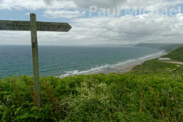
The stretch of coast path between Downderry and Portwrinkle is beautiful. It undulates, curves and swerves along truly magnificent scenic vistas for about 2.5 miles. Rame Head can be seen as the furthest point with fantastic views of the many beaches that make up Whitsand Bay. Walking this path gives you a real sense of what SE Cornwall has to offer its locals and visitors.
It’s worth doing this part of the walk as a short outing if you are able – perhaps there and back. Pop into the Inn on the Shore at Downderry for a bite to eat and refreshments as a reward.
Portwrinkle
I love the names that are given to areas along the coast – Beaks Horn, Eglarooze Cliff, and Britain Point. The coast path does a steep decline down many steps into Portwrinkle – its Beach, the harbour and onto Finnygook Beach. This is an interesting name. Maybe the Finnygook Inn, a wonderful, friendly pub restaurant up the hill in Crafthole, took its name from the beach, or maybe elsewhere.
It is said that Portwrinkle got its name from early navigators where there was found a port on the fold or wrinkle of their map. I guess otherwise it might have been named, Finnygook.
The photo of Portwrinkle above shows a large manor house structure. This was the Whitsand Bay Hotel. It has closed now and is likely to be converted to apartments or similar. Its history is of a manor house, Thankes House, but not here in Portwrinkle. It was dismantled and reconstructed, stone by stone, from Thankes Park in Torpoint
There is a cafe at Portwrinkle, The Jolly Roger, which serves hot and cold meals and refreshments.
Portwrinkle and Crafthole are popular with holiday-makers and golfers. Aside from the lovely beaches and scenery, there is the Whitsand Bay Golf Club, with its course right on the coastal cliffs. Just look out for us walkers when you’re batting your balls around!
Along with the Finnygook Inn, there are a few holiday properties at Craftole and Portwrinkle.
Walking East of Portwrinkle in SE Cornwall
From Portwrinkle, there is a nice little loop to Crafthole. Stay on the coast path and walk to Tregantle Fort and then loop back on the road to Crafthole for a stunning 5-mile walk from Portwrinkle, or a 14-mile walk from St Germans.
Whitsand Bay
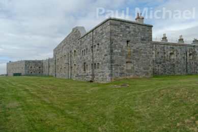
The Bay is quite extensive and incorporates many beaches. Some are better known than others. For example, Tragantle Beach, overlooked by Tregantle Fort, is probably best known to visitors from Plymouth and maybe outlying Cornish towns. There is no doubt, it is a beautiful, long beach of golden sands. The paths up from all the beaches range in steepness, length and difficulty. The path at Tregantle is not too bad, especially for families with all their beach gear.
Personally, I prefer the beaches further along the coast road. Freathy and Treganhawk are superb and are rarely overcrowded.
There are lots of places to stay at Whitsand Bay. There are many holiday chalets that are let privately or via booking sites, as well as Whitsand Bay Fort Holiday Village.
St Germans to Antony
Taking the main theme of these excursions further, I have stomped from St Germans to Portwrinkle to pick up the coast path to Tregantle Fort.
From Tregantle, walk along the Whitsand Bay cliff road, which has a few off-road coast paths along the way. Then, just past the Whitsand Bay Fort and the View Cafe, turn inland to Millbrook.
There is a lovely lake at Millbrook where I often pop into the Co-Op in Fore Street and grab a meal deal or similar and head for a bench by the lake. Just beware of one or two of the swans – they’ll try scaring you into feeding them. You have to munch when they aren’t looking.
For some reason, the people of Millbrook thought to build their school atop a killer hill, which is also the route to St John. Maybe the hill is not so bad had you not walked about 9 miles already. Millbrook kids must have muscular legs.
St John is a quiet and quaint village with a great little pub, the St John Inn. They offer camping along with camping pods and even a camping boat! I’ve been infrequently visiting this pub for decades and, aside from the camping additions, it really hasn’t changed much at all. It is a comfy, proper pub.
From St John, it’s a walk up the hill to St John’s Wood and then on to Antony. Another great pub and restaurant, the Carew Arms, at Antony, offers great food and refreshments. They also offer accommodation.
This walk is about 13 miles but can be cut shorter by taking the inland lanes to Antony from Tregantle or Cliff Lane (via St John).
As the photos above show, there’s some breathtaking SE Cornwall scenery. If you can do the whole walk, you will be rewarded with excellent views across Torpoint, Plymouth and beyond to Dartmoor on a clear day when taking the Whitsand Bay to Millbrook lane.
St Germans to Kingsand
Occasionally I like to hike further on from Whitsand Bay to Rame Head, Penlee Point and onto Cawsand and Kingsand. There are a couple of routes from St Germans: the shorter Portwrinkle route or walking the lanes to St Germans Hut, which makes this a 16 miler. I did this walk in the Spring of 2022 when a vintage bus service was organised to link the towns and villages of the Rame Peninsula, as well as St Germans and Polbathic. I must write about that someday, it was a great idea and was well attended.
Kingsand & Cawsand
Kingsand and Cawsand are tourists and day-visitor magnets. One village flows to the other along the coast, just past the Breakwater out of Plymouth Sound. What’s not to like? There are Cornish cottages lining the streets, shops, pubs, and restaurants. There is a beach at Cawsand and another at Kingsand, albeit a little stonier. I love the flat rocks that lead out of Kingsand that look like a lava field.
Kingsand and Cawsand have all the ingredients needed for a Cornish holiday or short break. Including some wonderful holiday properties both in and around Kingsand and Cawsand.
There is a ferry service from Cawsand to Plymouth or vice versa. It’s possible to do this walk in reverse and then catch a train home from St Germans.
St Germans to Cremyll and Plymouth
This is 15 miles, walking from St Germans to Portwrinkle and Whitsand Bay. Turning inland at Ninney Rock to Treninnow. Keeping to the lanes to Anderton, east of Milbrook leads to Mount Edgecumbe.
Mount Edgecumbe is a country park. Walking here you soon realise that it is such a special place for residents and visitors to SE Cornwall. It is free to enter and roam with a couple of good cafes and restaurants. Look at their website to see what’s on – there are lots of activities and events with plenty to see throughout the year.
There are far too many shorter walks and bimbles in this area for me to mention here. The Park is very popular with my family and we have had many great days there over many years.
From here is also the Cremyll Ferry service to Stonehouse, Plymouth. You can pop into the Edgecumbe Arms for refreshments while waiting for the ferry, which runs all year round. There is a reduced service in the winter months.
This walk could also be reversed to end in St Germans with a train back to Plymouth.
St Germans to Millendreath and Looe
Another alternative is to get to the coast path at St Germans Hut or Seaton and head west to Millendreath and onto Looe. The longest of the options is 14 miles.
Millendreath is a sandy beach cove. The most noticeable aspect as you walk in is Millendreath Beach Resort, which occupies pretty much all of the lower area stretching back to the large car park. There is a beach cafe, bar and restaurant. I can quite happily sit on the wall, perhaps with a coffee or a beer, and watch people on the beach enjoying themselves.
Looe has a branch line train service, as well as buses to Liskeard. They are not as frequent as mainline trains, so it pays to plan the trek and journey home.
I love this walk, especially in the summer when the holiday visitors pour into these SE Cornwall resorts, which are very reliant on tourism. It is wonderful to see flocks of people on our beaches, eating and drinking in our cafes, pubs and restaurants, and staying at our campsites, guest houses and hotels.
I also like this hike in the winter when the skies are more dramatic. Christmas time at Looe is lovely.
Staying in Looe
I love Looe. It’s strange because I think that many locals may be put off by it being that typical Cornish seaside town for tourists. I think there is more to Looe than people think, especially if you walk the coast path on either side. You get to see parts of Looe that, maybe, most people don’t get to see and appreciate. I visit a lot over winter with my wife and family. Looe takes on a different feel at winter – calm and charm.
There are plenty of hotels and holiday properties in and around Looe and Milendreath.
Looe is a little out of the way to catch a lift home. So this walk often ends with a wander around Looe’s shops with a tasty meal in one of our favourite pubs.
Sometimes it’s worth looking closer to home with a little forethought and imagination to see what is possible. If you would like to get into walking, read my article, a Beginner’s Guide to Hiking and Walks.
Thanks for reading this article. I hope this has got you thinking about walking in SE Cornwall.
[products limit=”16″ columns=”4″ category=”SE Cornwall” orderby=”date” order=”DESC”]

