Last Updated on 19th October 2023
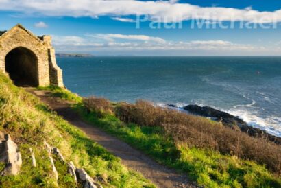
Rame Head is a beautiful landmark and coastal headland in SE Cornwall. It is a pyramidal-shaped rock that juts out to the sea to the west of Plymouth Sound. Atop the rock is St Michael’s Chapel, a disused structure, but nevertheless, thousands of visitors to this area clamber up the steep slopes and steps to look inside the chapel and take in the breathtaking views for miles on either side.
Zooming out from Rame Head on a map, there are waterways surrounding a peninsula that starts just to the west of the village of Rame, around Cremyll and the hamlet, Edgecombe. It takes in Penlee Point, Cawsand, Kinsand, Picklecombe and Mount Edgecombe Park along the way. Each of these locations holds its own unique selling points.
Although I have walked this area for many years, it was in smaller bites. As a family, we would visit Mount Edgecombe frequently. We’d visit Cawsand and Kingsand for lunch or dinner in one of the local hostelries after a walk around the area.
Rame Peninsula is rich in history and attracts thousands of visitors and holidaymakers. Take a look at Rame Peninsula books and art resources.
The Rame Peninsula Challenge
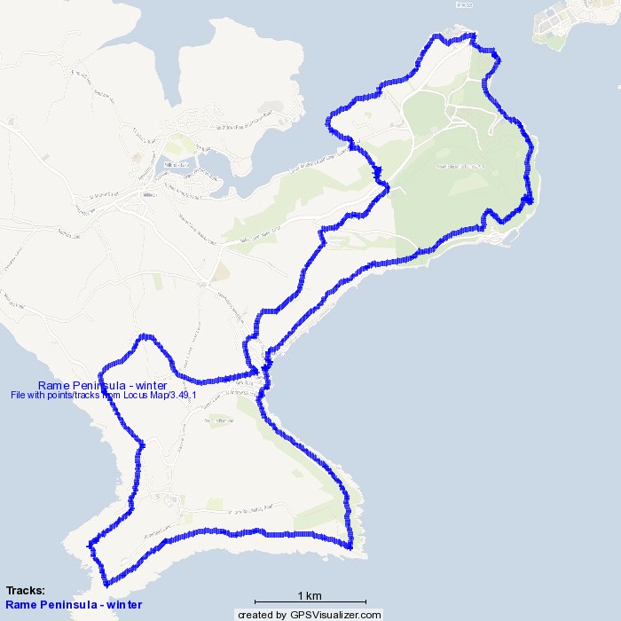
It was in 2017 when searching for ideas for a charity walk with some work friends, I considered walking the whole peninsula and named it, The Rame Peninsula Challenge. For the uninitiated hiker, the 13.5 miles of mixed terrain really is a challenge. This is more of a lovely day out for the seasoned stomper.
Since 2017 I have modified the route a few times. The most recent change was December 2020 where, after way too much rain and storms, I kept the route to more stable pathways. So I now have a collection of routes for this walk that ranges from 12.5 to 14 miles.
This walk can be taken as two shorter circular walks, as shown on the route map. This is great for people that maybe want to take this in one or two chunks.
Here is the GPX File that can be used in GPX Apps or devices. If you want to know more about this, read my article, Top Tips: Mapping & GPS for Hiking.
Wiggle to Cawsand
Well, you can if you want!
All of my routes start in a small free parking area near Wiggle Farm on the Whitsand Bay coast road (where the writing on the map above crosses the route). My latest version took a clockwise trek, but I would usually do this anti-clockwise. The main difference is that the footpath between Cawsand and Wiggle farm is pretty steep and arduous, especially if this is at the end of the walk. It’s less strenuous to do it clockwise, as well as doing all the not-so-scenic inland pathways first, so I have used the clockwise version for this article.
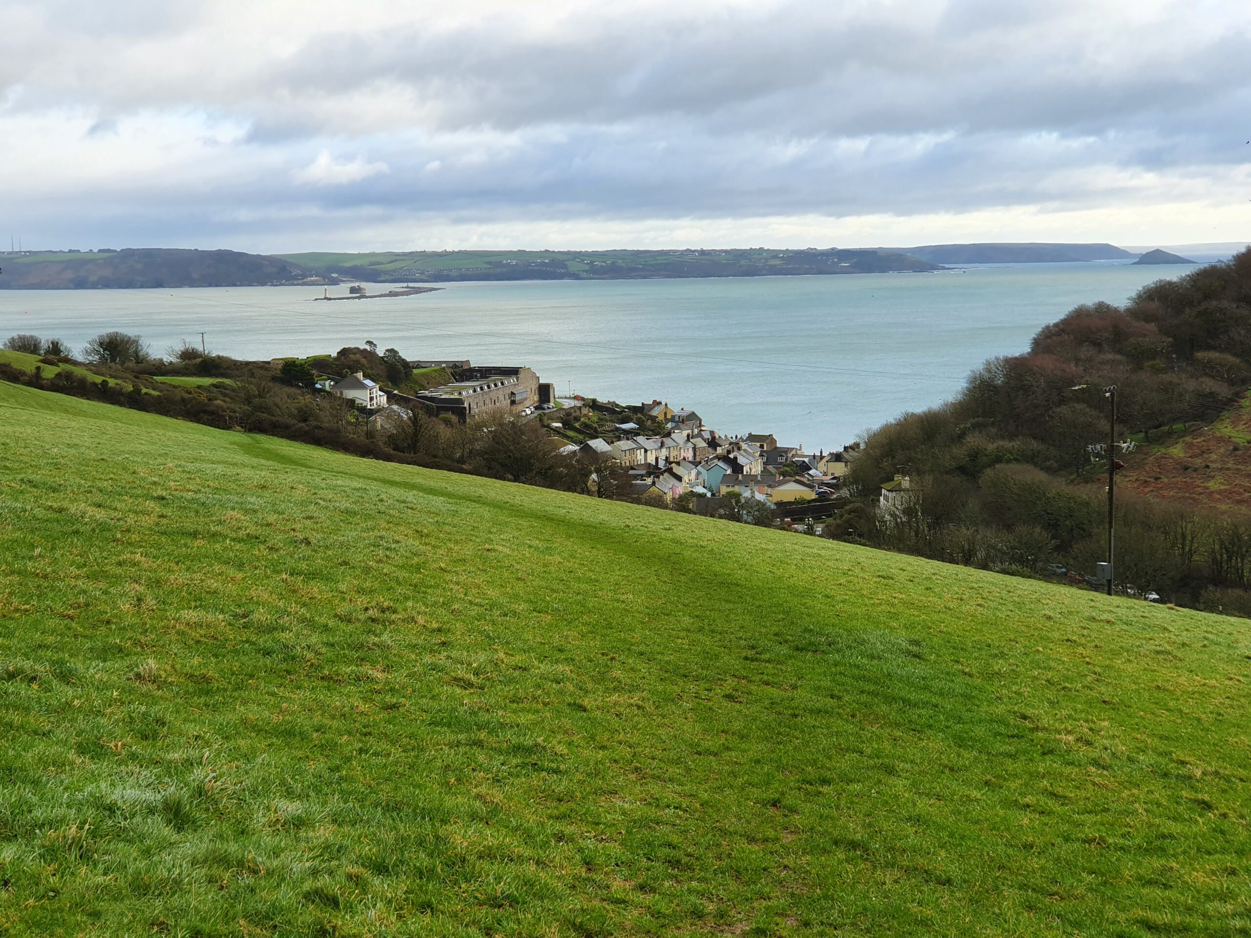
The route first heads northeasterly along a lane and then southeasterly over the fields and down a steep incline to Cawsand. It’s easy to follow, winter or summer months, even though it diagonally crosses a couple of fields. I love the view from the heights, overlooking Cawsand and Plymouth Sound beyond.
Cawsand to Maker Heights
The public footpath comes out onto Cawsand’s top road – beware of the traffic – and the route is left and on to a crossroads. This is a new section I added – walk up the steep lane, Earl’s Drive. There is an alternative public footpath, but it’s very steep and muddy at the best of times. The lane eventually evens out and passes Grenville and Hawkins Batteries which were built and re-modelled in the late 1700s to defend the Royal Naval Dockyard. The route takes a right turn and then back onto the public footpath on the left after two hundred metres or so.
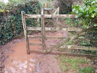
There is a very muddy section of this pathway at a gated entry – so be prepared.
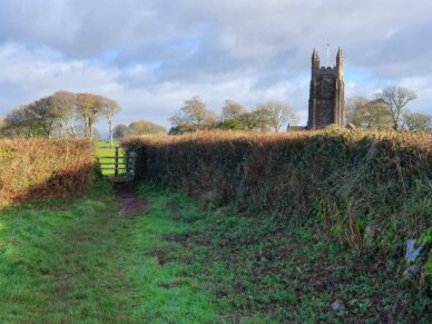
As the pathway levels out, the tower of Maker Church comes into view. The church can be seen for miles around and is a Grade I listed building from the 15th century. Locally known as Maker Church, it is in fact the Church of St Mary and St Julian. There is a small churchyard and some of the headstones are Grade II listed, dating back to 1735.
Maker to Cremyll and Mount Edgecumbe
At NNW to the church, there is a public footpath signposted (faded) to Edgecumbe and Cremyll. It leads down a field to the main road – this road is busy in the summer months. Cross over to continue down the pathway into the woods. The path is very steep and can be slippery after prolonged rainfall. There is a rope handrail along one steep section of this path, which is another example of how this walk is easier when doing it clockwise and walking downhill! I’ll never forget my teammate’s expressions when they got to this point having done the ant-clockwise route after 10 miles or so. Let’s just say that the language was a little blue.
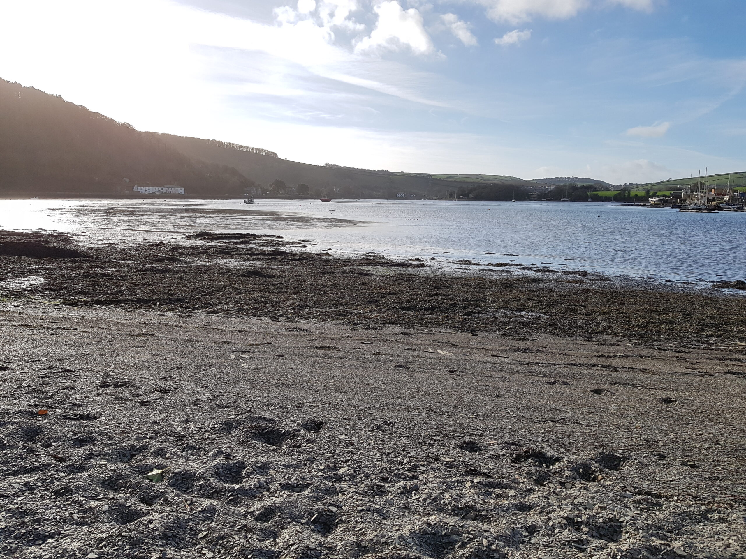
The pathway comes out of the woods, crosses over another footpath, and then continues on down a field as it sweeps into a gate onto Lower Anderton Road. Continue across the road and through the field opposite with a riverside beach on the left. There are a few places to get down onto the beach when it’s drier weather, which is a great place to stop for a bite to eat and to take a rest.
The footpath works its way around the riverside with Southdown Marina opposite. As it heads east, a cylindrical tower comes into view. I have no idea what this is and I hadn’t spotted it prior to doing this clockwise version. Note to self: look back occasionally!
A little further on and the pathway opens to an idyllic hamlet setting, comprising a terrace of lovely cottages with a small harbour. There is also a rather impressive fort-like entrance to the kitchen gardens that were once part of the Mount Edgecumbe Estate workings. Today, there are some beautiful cottages available for self-catering accommodation to enjoy this wonderful little spot on the River Tamar.
Walkers need to keep close to the harbour wall and, as it levels with the row of cottages, step onto the pathway to continue on to Edgecumbe Street. The building here looks like old stables but may be used for other purposes today.
The waterside pathway carries on around to Mashfords boatyard before finally getting into Cremyll. The Edgecumbe Arms is to the left, offering fine food and beverages all year round.
Mount Edgecumbe
From Cremyll, it’s through Mount Edgecumbe Park’s grand entrance and along the path that skirts the waterways of the River Tamar and Plymouth Sound. The Orangery also offers wonderful food and refreshments and, in the summer months, there is a food outlet just inside the gate on the right.
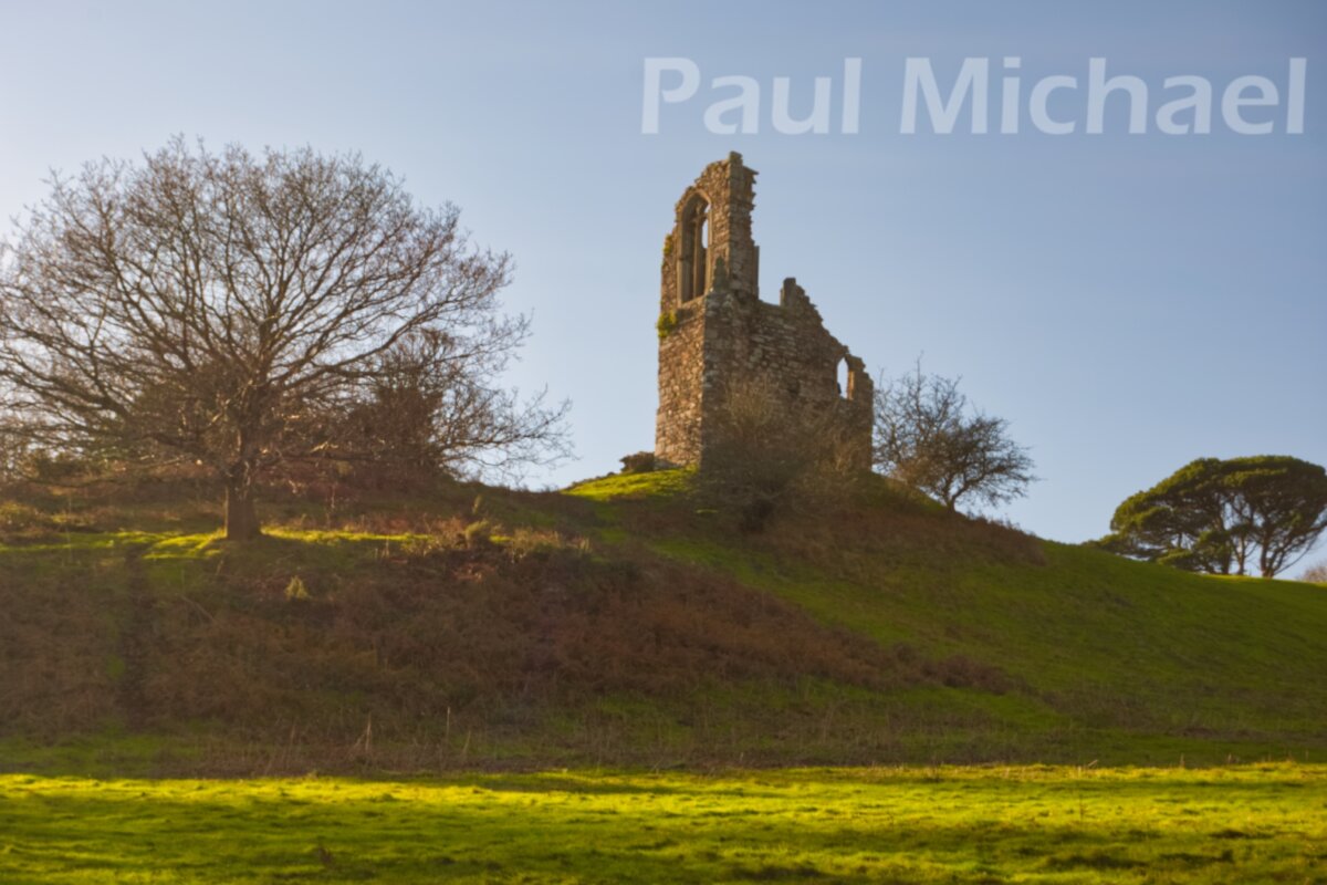
Mount Edgecumbe is very popular with visitors and locals. There is much to see and do here. It’s easy to spend an entire day getting lost in the gardens, which are very well cared for and offer very diverse garden themes and displays. The House is sometimes open for special events. For this hike, though, it’s a walk through the park via the SW coast path. Look out for Milton’s Temple by the lake and the Folly up a steep incline along the way.
Mount Edgecumbe to Picklecombe, Kingsand & Cawsand
During the storms in 2017, a large tree had come down onto the coast path and, for some reason, hasn’t been removed. There is a detour that leads up a steep section with steps and, after going past a structure with a lookout platform, it heads back down again. It joins on to the upper of the two paths. Walk on a little further to see a bit of a cutting down a woody slope to link up with the lower path.
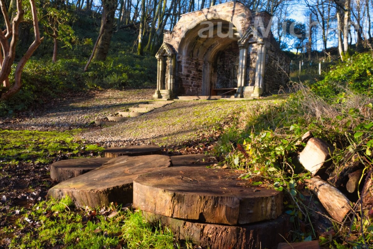
There is good reason to get down onto the lower path. Just a few metres on there is Picklecombe Seat. It’s Grade II listed and of a temple design. I’m not sure if this is more ‘garden furniture’ than of any other former use. It sits high on the hill above Fort Picklecombe, a converted fort structure comprising luxury apartments.
Follow the coast path around Picklecombe and along until it descends down and onto the Fort Picklecombe approach road. Just a little further on, just past the Hooe Lake Scout Campsite, there is a gate on the left to the next section of the SW coast path onto Kingsand.
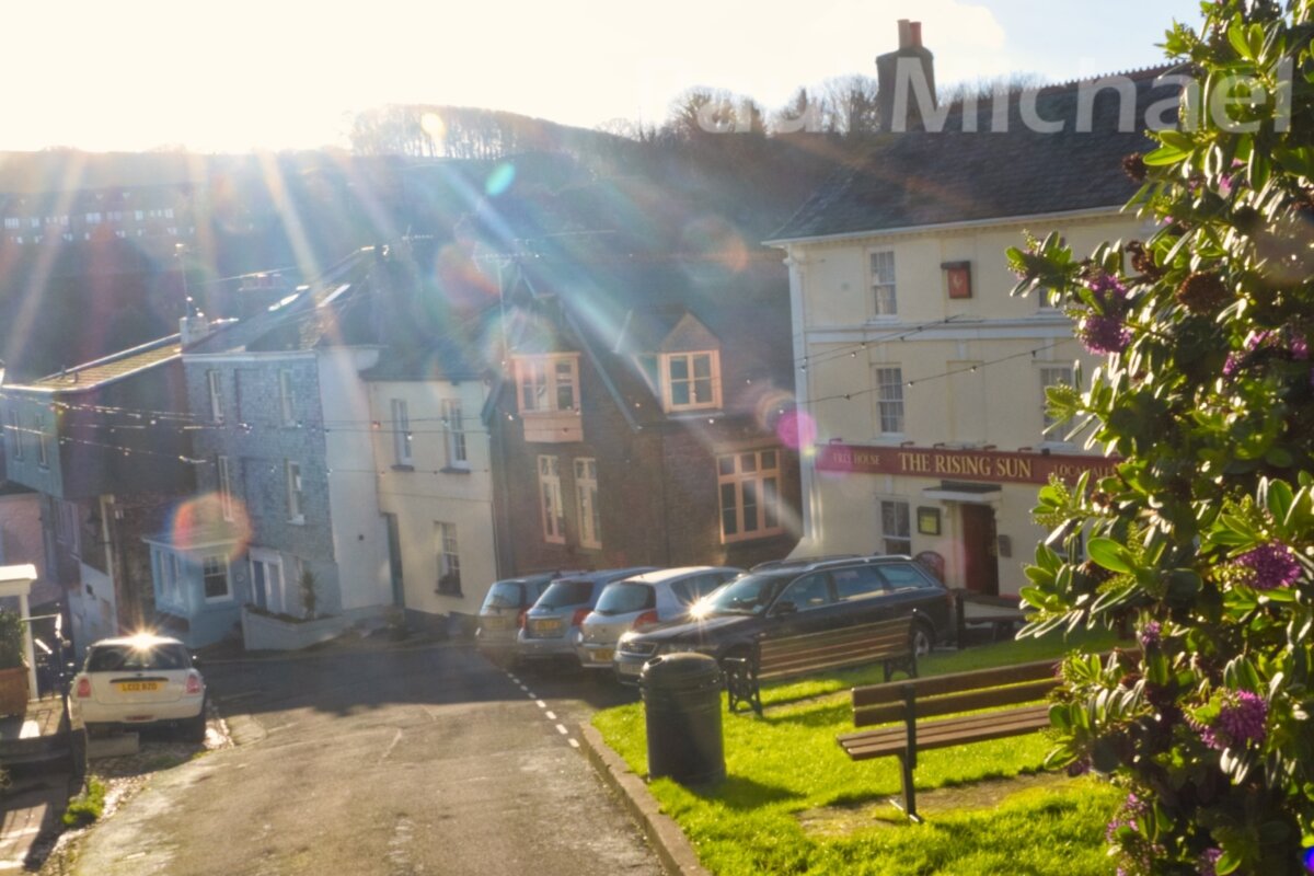
The path enters Kingsand near The Rising Sun, which might be very welcoming for a pit-stop drink or a bite to eat. When I last visited in December I was welcomed by a very bright sun shining low over the pub – how apt!
Kingsand and Cawsand
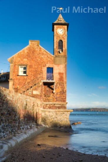
Walk along the quaint and narrow streets of Kingsand and around into Cawsand. Look out for the clock tower at Kingsand, which stars in many storm-themed photos and paintings. The beach at Cawsand is lovely to soak up the views and atmosphere. There are a few pubs and a beach-front bistro bar, plus an ice-cream outlet, along the way for more eating or refreshment options.
There are many reasons to make Kingsand and Cawsand your destination for a great holiday or break in SE Cornwall. the villages merge into one another along the coast with narrow lanes and stone cottages. Along with quaint shops, restaurants, pubs and beach attractions, Plymouth can be reached by a passenger ferry. The amazing Whitsand Bay is not far by car either. So, no matter what the weather, there is plenty to see and do. Here is a list of hotels and holiday properties in and around Kingsand and Cawsand.
Cawsand to Penlee Point and Rame Head
The road leading out of Cawsand turns a right bend, and the SW Coast path is sign-posted. This leads further out along Plymouth Sound, past the Breakwater and on to Penlee Point. This is a popular fishing spot for the locals but, rather than going all the way down to the rocks and often choppy seas below, just a few steps down will reveal a stone structure – Queen Adelaide’s Grotto – thought to have been built in 1828 for her visit with King William IV, maybe just before taking to the throne in 1830.
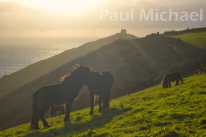
The route heads westward on track for Rame Head. The approach to this fascinating headland is very photogenic and, whatever the weather, there will be lots of opportunities. Look out for the wild ponies on the approach to Rame Head. They don’t mind people coming quite close to take a picture or two but be courteous – even if they won’t pose for your special photo. Believe me, they won’t!
If time permits, a jaunt up to St Michael’s Chapel atop Rame Head is well worth the effort. There is a large ex-gunnery platform on the other side of the chapel to take in the views. There is a path down to the rocks at the headland’s most southern point, but this can be quite dangerous, especially in the winter months.
Rame Head to Wiggle and Home
The coast path isn’t so obvious when continuing out from Rame Head. It follows the cliff edge, first northwesterly and then, down a series of steps, it turns northeasterly. The path finally heads down a steep stairway onto the Polhawn Fort-owned tarmac road. At this point, there is a choice. Continue along the coast path by simply crossing over the road. Turn right if you prefer to walk along the tarmac road. I prefer the latter in the winter months with the fading light.
If you choose the coast path, it hugs the cliff and onto a white chalet. I’m really quite envious of the owners (Mount Edgecumbe Estate) who renovated it from a rather derelict state a few years ago. The hard work, along with laying and strengthening the driveway down to it, has paid dividends, I’m sure. You can rent this holiday property.
Whether on the coast path or on the road, both lead to the starting point of this wonderful walk. I registered 12.5 miles when tracking the route.
There are some lovely places to get a hearty meal and refreshments to end a perfect day. Here are a few you may find on your way home…
- The Carew Arms – Antony, on the way back to Torpoint
- The Liscawn – near Crafthole, on the way back into Cornwall or via the Tamar Bridge
- The Finnygook Inn – Crafthole, as above.
If you are new to walking, read my article, A Beginner’s Guide to Hiking and Walks. It provides lots of advice to get you going and enjoy the many benefits associated with walking.
Comment below with your experiences of this area.

