Last Updated on 29th May 2023
My first big walk of the summer season needed to be somewhere special. Well, this walk certainly meets that requirement. This is a guide for a circular walk around the Penhale Dunes and Pentire Headland.
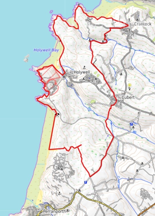
This 13-mile walk starts at Cubert Common and heads southerly inland. It then heads across the dunes of Penhale Sands to the remains of St Piran’s Church and Oratory. Then onto Perran Sands, north to Holywell Bay, Porth (Polly) Joke Beach, Pentire Headland. Finally, it’s east to Crantock before heading back to Cubert Common. I actually walked 16 miles in the end, partly due to going off-piste a few times for the photos, but also in trying to find the best routes across the dunes.
As it’s a circular walk, you can do this in an anti-clockwise direction. It can also be cut into two or more shorter walks. The choice is yours, but this guide is based on a clockwise direction. You should allow at least 6 hours of daylight for the whole walk. More time will be required for extended breaks and looking around the attractions along the way.
You can download the above map, or you can see this route on OS maps.
If you are new to walking or maybe want further hints and tips, read my article: A Beginner’s Guide to Hiking and Long Walks.
Car Park and Start of the Walk
Set your satnav for Cubert Common where there is a National Trust car park. You should come in via Crantock Village and then turn off down a lane to arrive at a gate by Treago Farm. Go through the gate and drive a further quarter-mile along the gravel path. As you turn the corner there is another gate to the car park. There is an honesty box where the charge was £2 when I visited. It’s free to NT members.
Cubert Common to Cubert Village
Once booted and ready to go, walk back out through the gate and turn right up the path heading south. As the incline starts the level, take the right fork to arrive at a farm property. Continue walking along the made-up path heading southwest. It merges onto a road that leads into the lovely-looking Cubert Village.
Walk across the main road through the village at the junction to Ellenglaze. As the road continues south and then to the west, the public footpath is signposted a bit further down the hill.
Cubert to Seven Bridges
The footpath starts off down the hill as a concreted path. However, that is only down to the gated water treatment plant. It seems that you can’t go any further, but hop over the grass verge to see the path on the left to walk around the waterworks, through a gate, and continue down the path on the other side. On my visit, this was like walking down a stream. It was very overgrown and very wet!
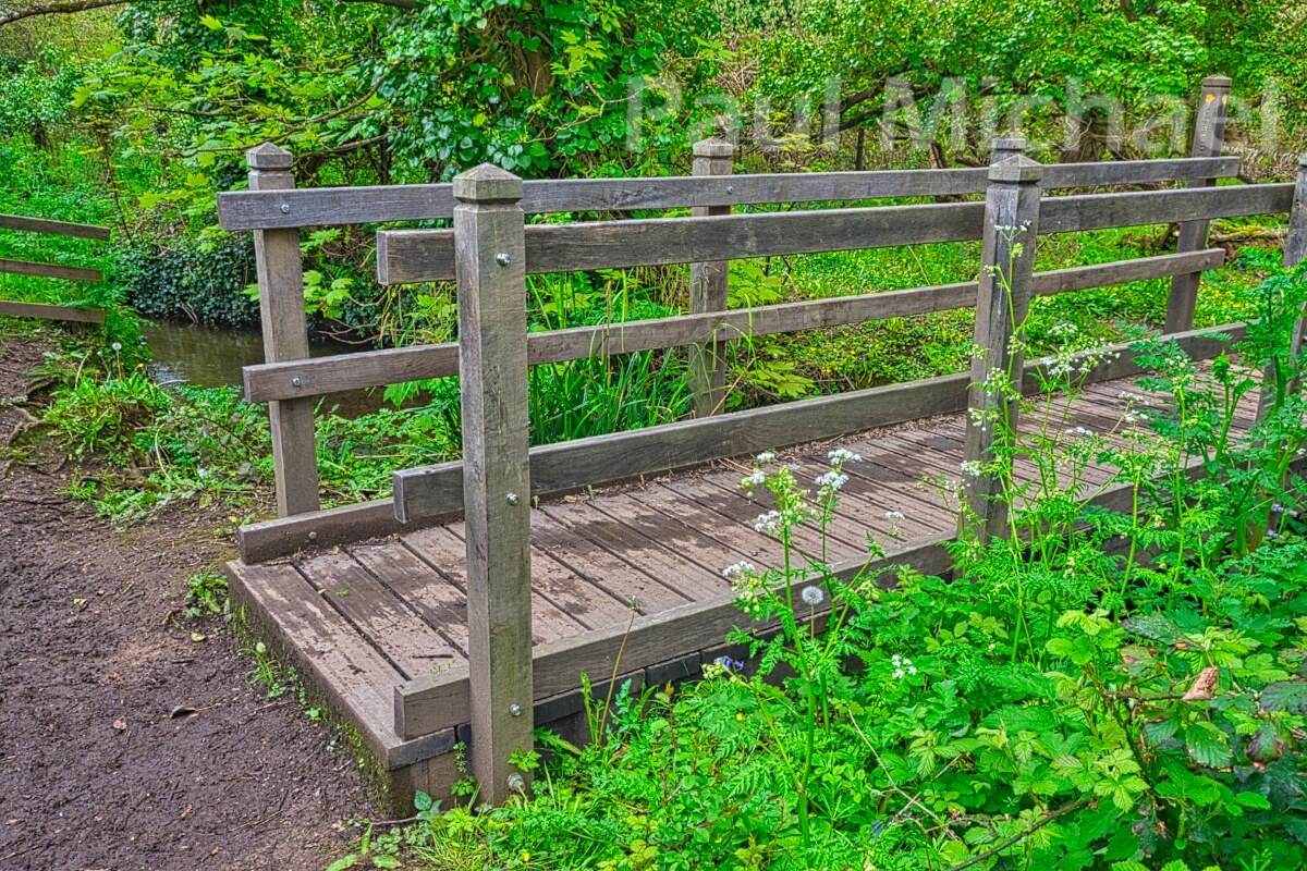
The path eventually levels out in a marshy valley with a river flowing through. It is such a tranquil and picturesque spot that greets you with a wooden bridge, signposted Seven Bridges. I wondered why. Well, yes, there are a further 6 platform-styled bridges that cross over a series of marshes. This must be a very important natural wildlife habitat.
The path comes out onto a road heading southwest up an incline. Eventually, it levels a little and there is a layby on the right with a ‘Keep Clear’ section marked on the road. This is the entrance to an open common area and a not-so-obvious path to Penhale Sands.
Penhale Sands
Penhale translates as St Piran’s Sands (from the Cornish Peran Teth) and dates back over 5000 years. It is one of the most extensive ranges of sand dunes in the UK.
It is said to be the place where St Piran was washed ashore in the 5th century after being outcast from Ireland tied to a millstone. He is a patron saint of tin miners and many regard him the patron saint of Cornwall.
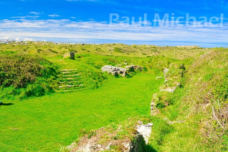
In the 1800s, St Piran’s Oratory was discovered. It was further excavated recently in 2014. Believed to be dated from the 7th century, it is one of the oldest Christian sites in the UK. It was abandoned in the 10th century due to constantly being overcome with sand.
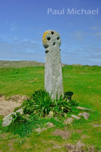
A little further east is the remains of St Piran’s Church, which was built as a replacement for the Oratory. The church had a stream running nearby, but mining in the area dried it up. Without the protection of the stream, the replacement church was overcome with sand and abandoned in the early 1800s. St Piran’s Cross is a few metres away from the church and is the oldest stone cross in Cornwall.
Penhale Sands is an important conservation area for wildlife. The birdsong was beautiful as I was passing through. The area is also popular with dog walkers. It must be a real benefit having this nearby.
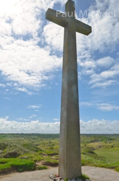
Walk NNW, steadily rising with the holiday park to your left. Eventually, you will see the tall stone cross. Keep this a little to your left. Walk past the cross and come upon a cross path. Walk east along it to visit St Piran’s Church and St Piran’s Cross.
Then walk back along the path past the point where you joined it. A little further on, it snakes right then left to get to the Oratory.
From the Oratory, walk towards the tall stone cross. This is St Piran’s Oratory Cross and is around 150 metres southwest of the Oratory.
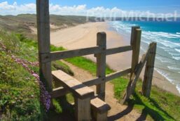
After a good look around this area and perhaps a refreshment break, continue along the cross path heading west, following the fence, towards the coast. The fence and path turn to the north and, after a short ascent, the beauty of Perran Sands comes into view.
Perran Sands
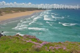
A beach of golden sands that stretches for miles. It is quite breathtaking to see as you come over the top of the sand dunes.
The awkward part is to try and find a route over the dunes to follow the line of the beach. I decided that it wasn’t to be and so I headed for a fairly safe route down the dunes to the beach. I walked along the damp part of the sand – it’s much easier on the feet.
Towards the end of the beach, look up to see a hut structure. Look down from this and you will hopefully see the same path as I did that heads up through the dunes. It’s fairly steep at the start. I use walking poles and these are a great help in situations like this. Although, as I ascended up, I crossed a better made-up path that may well be a better choice had I walked a little further along the beach.
Perran Sands to Holywell Bay
Towards the top of the dunes, the coast path goes around a cave and disused quarry. It then heads off NW to Ligger Point. The views back over Perran Sands are simply stunning from here.
The coast path follows the coastal cliffs and the fenced-off Penhale Camp, an army base that now looks as though it ought to be given up for local housing, such as its decay.
Continue along the coast path, past Hoblyn’s Cove, to arrive at the next headland, Penhale Point. Holywell Bay and Kelsey Head come into view.
The coast path veers eastwards into Holywell.
Holywell
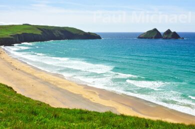
Holywell Village in Holywell Bay is a very popular tourist location. Approaching the area from the coast path, you can see why.
Holywell is home to a number of historical and cultural attractions, including a natural spring that is said to have healing properties and is known as the Holy Well. There is also St Cuthbert’s Cave with its natural spring that is said to have been used by St Cuthbert, a 7th-century saint.
The familiar rocks out in the bay are known as Carter’s Rocks or Gull Rock.
The route goes into Holywell, around a pub and car park, over a small river and then back out onto the coast path once more. The pub provides food and refreshment, and there is likely more establishments further in the village.
Kelseys Head
From Holywell, the route is over yet more dunes for a short stretch. It then eases into a better path out to Kelseys Head. I didn’t spot the remains of an Iron Age cliff castle. I found out about its existence when writing up this guide.
There are also three tumulous (ancient burial) sites along the way out to Kelseys Head.
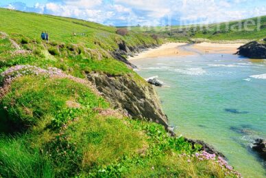
The route veers in a southeasterly direction and, as it does, the most stunning views of Pentire Point West come into view.
Porth Joke
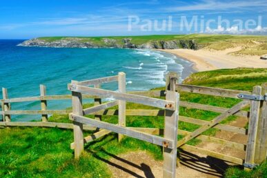
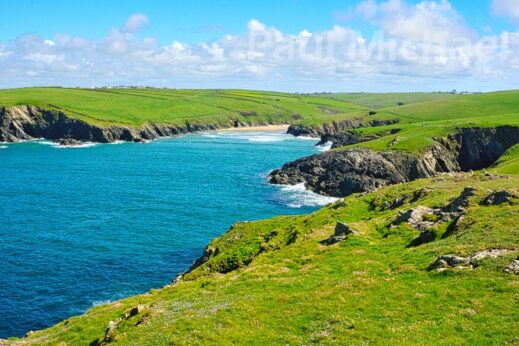
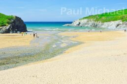
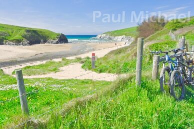
A little further along, the long channel and the distant golden sands of Porth Joke can be admired. I stopped a number of times along the way to take it all in.
Porth Joke is known locally as Polly Joke. It’s thought that this name comes from the Cornish – Pol-Lejouack, which translates as Kackdaw Cove. I didn’t see any Jackdaws, but there were plenty of crows.
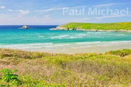
As you get closer to the golden sands, you can’t help to be mesmerised by the rugged seas washing into the cove against the rocks, the beautiful beach and the overall beauty of this area. It really is a special place that, where it is quite difficult to get to, is seldom overrun with people.
There is a river that runs through the valley and out through the beach to the sea. The route is over the bridge and back out on the opposite cliffs of the Pentire Headland.
West Pentire Headland
Continue to take in the views of Porth Joke and, now, Kelseys Head from the opposite side.
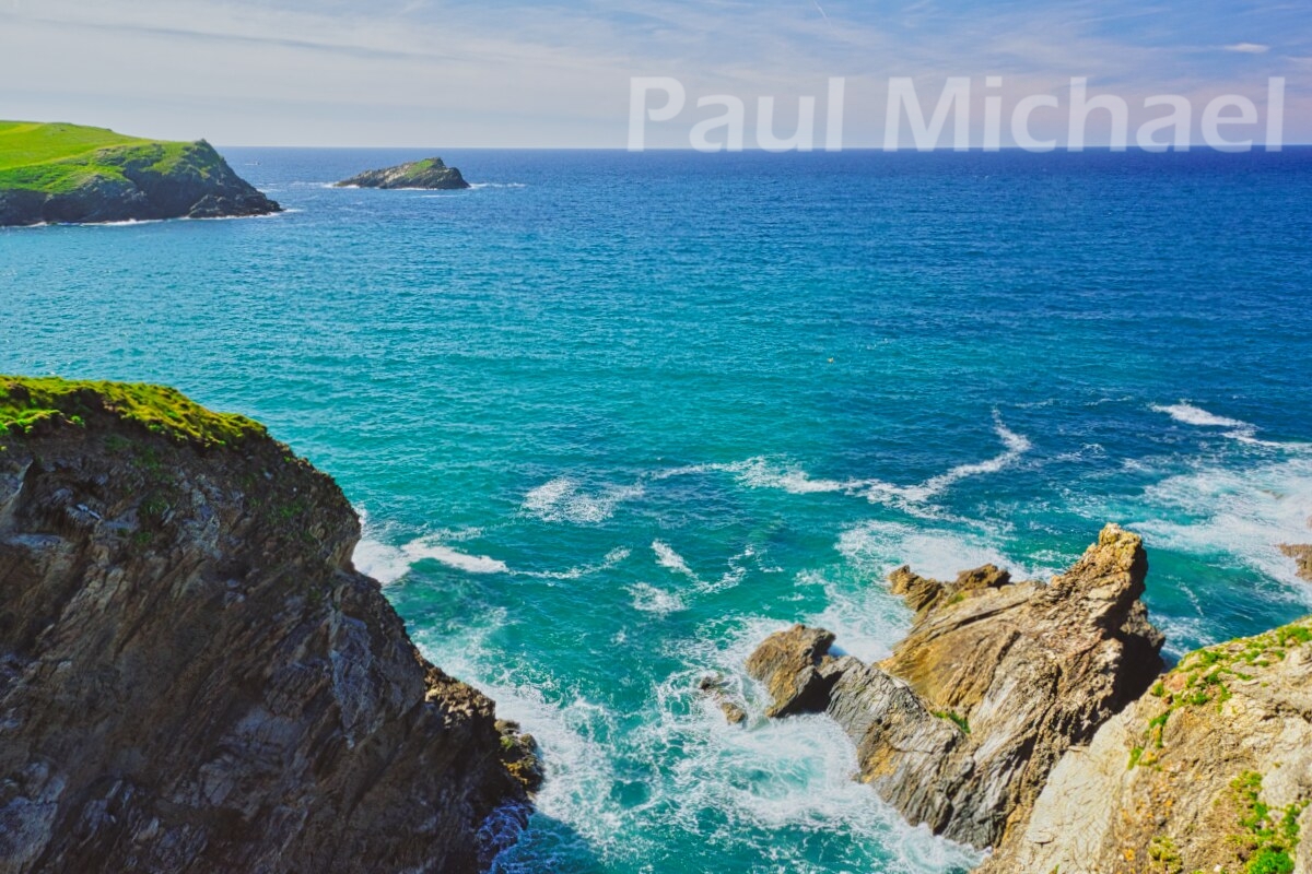
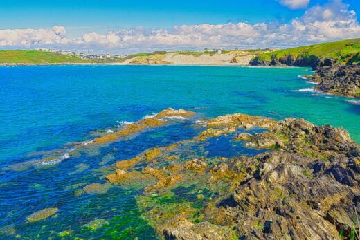
Yet more breathtaking views are to be enjoyed heading out to the head – on OS maps marked as Pentire Point West. Around the headland and we see Pentire Point East across the golden sands of Crantock Beach. How much of the beach you see is dependent upon the tide, which goes out quite a way on low tides.
Into Crantock
Further amazing scenes are to be had as the coast path wends its way towards Crantock. Looking across Crantock Beach, the cove is larger than that of Porth Joke. The larger river, Gannel, flows out through Crantock. The rock out in the bay is known as The Goose.
It gets very busy here in the summer months, which is understandable given the beauty of the place with its sandy beach, where surfing, swimming and sunbathing are popular. Crantock Beach is a Blue Flag beach, which means it meets the highest standards of cleanliness, safety and environmental management. I tried to capture the crystal clear waters with a slight green tinge in my photos.
Further towards Crantock, the path is made up of a tarmac surface. If, like me, you use walking poles/sticks, don’t put them away just yet, as I did. The path takes a left turn and is back onto a rough and ready surface along with a flight of steps, which play havoc with my knee.
The coast path gets into the village and, no sooner than you arrive, the route is back out again on the road.
If you have time, within the village, there is St Carantocus Church, a Grade I listed church dating from the 12th century. Also, look out for The Old Albion Inn, a 400-year-old thatched pub.
There are no facilities at the car park, so it may be worth seeking them out in Crantock before finally heading back.
Treago Farm and Car Park
From Crantock, the road leads out and there is a left turn that you’ll recall is the car route taken at the start of the day. Down the lane, the route goes through the same two gates to end up back at the car park.
That’s it, the walk is over and now is the time to head home. I hope you enjoy this walk as much as I did, and have a camera full of photos to look back on it. Let me know about your experiences of walking in this area below.
Take a Holiday in the Perran Sands, Holywell and Crantock Area
Penhale Sands and the Pentire Healand is a wonderful area of Cornwall to take a short break or a longer holiday. Not only can you experience all that I have described above, but this also makes a great base to visit many more Cornish attractions.
Here is a list of hotels and holiday properties in Holywell Bay and the extended area to Perran Sands, Pentire and Crantock.
Fancy a book to read while relaxing in this beautiful area? Here are some books about North Cornwall and its towns, villages and attractions.


