Last Updated on 13th January 2024
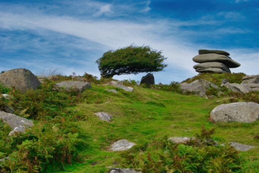
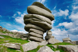
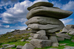
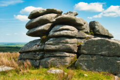
Minions Moor and Twelve Mens Moor have been my favourite walking areas on Bodmin Moor for many years. The Hurlers stone circles and the Cheesewring are the most visited parts of Bodmin Moor. I love the shape and extent of the tors on Minions and Twelve Mens Moor. The rock formations look as though a giant has piled up massive stones like we might stack flat pebbles on a beach. Up close, I wonder why they haven’t toppled over yet. They look so precarious.
Where to park for a walk on Bodmin Moor? For this area of Bodmin Moor, there is a free car park on the south side of Minions village. It can get a bit crowded in the warmer months. There are more free car parks on the north end of Minions.
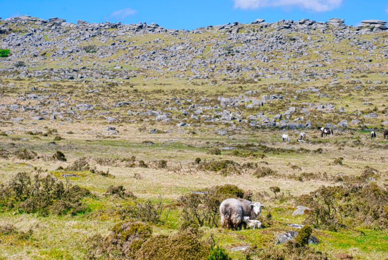
Can I walk my dog on Bodmin Moor? Certainly! However, there are many animals – cattle, sheep and horses – that roam freely. Please keep your dog on a lead. You can use a long telescopic lead, but it’s essential that farm animals are not put in danger. Just think of the Moor as a big open farm field.
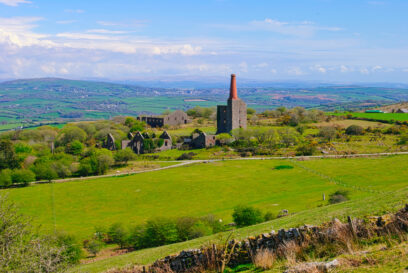
Is Bodmin Moor worth visiting and is it free? Yes! Bodmin Moor packs a great deal per square mile compared to, say, Dartmoor. So, aside from tors and beautiful, rugged moorland scenery, you also get the remains of mineral and metal mining and their stacks and engine houses. All of that with the animals, wildlife and plants make for a great day out in the wilderness, completely free of charge.
Walk Minions Moor to Twelve Mens Moor
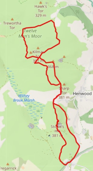
This Bodmin Moor walk is nearly 9 miles long and will take a good 4 hours with a break or two for food and refreshments. Plus, of course, taking photographs. As you can see, this circular walk can be shortened to two or three shorter circular walks.
There is a shop and cafe in Minions village but check the opening times. Otherwise, bring your own food and refreshments.
Here is a GPX file for you to use in your mapping tools and devices: Minions and Twelve Mens Moors GPX. Read my article, Top Tips: Mapping & GPS for Hiking for more information about using GPX files.
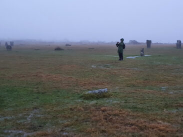
This is a moorland walk and the weather and conditions can change dramatically very quickly. I traced the route you see in February and the fog came down and gave me just 5 to 10 metres of visibility.
So do take additional layers, wet weather gear and appropriate walking shoes or boots. Read my article, A Beginner’s Guide to Hiking and Walks for further information and safety tips.
Short Walks
You don’t have to do the complete walk. You can visit the Hurlers, Cheesewring and the South Pheonix Mine Visitor Centre all for free and within a 2-mile walk. Then head into Minions village and grab a bite to eat and refreshments in the cafe or the pub (I hope it is being refurbished – there was scaffolding and no roof on it when I traced this route).
The Hurlers
The walk starts from the car park onto Minions Moor. Head out easterly onto the moor, either on the path or on the common, until you get to the Hurlers after about 5 minutes.
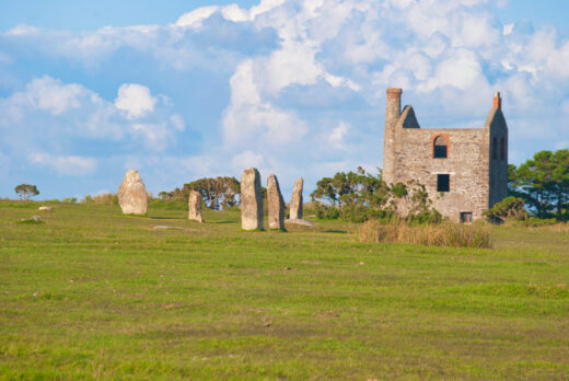
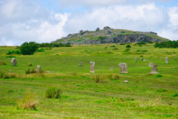
The Hurlers are three stone circles. Two of them are easily spotted but the third northerly one is more difficult to make out. Legend has it that each stone was once a human that got turned to stone for playing the game of hurling on Sabbath day.
Dating back to the late Neolithic or early Bronze Age time – about 3,500 years ago – they lay on a SSW to NNE axis. If a line is drawn through their centres, they align with the tumulous or cairn further up the hill. They also align with other burial sites found in this area, and so could be linked in some way.
Of further note, the pathway on the stones’ axis is part of an ancient route from the Lynher to the Fowey rivers – a trader’s route.
It is said that the axis aligns with Orion’s Belt on the Winter Solstice. This could be true and I yearn for a clear day on the Solstice so that I can see it for myself. It’s either raining, foggy, cloudy or all three or I’m busy. One day!
If you have time to explore this area, walk further to the east and you’ll come across the Pipers – two upright stones that many believe are the ancient entrance to the Hurlers.
Walk NNW through the centre of the Hurlers to a tumulus and then NNE to pass by a disused quarry. As you cross the disused rail track head due north and up Stowes Hill.
The Cheesewring & Stowes Hill
Atop Stowes Hill is Cheesewring Tor. This is a very impressive rock formation. As you walk up Stowes Hill to reach the tor, keep to the path that runs beside the fence (protects you and animals from falling into the disused quarry below).
What you see is an amazing stack of rocks that look as though they could topple over at any time. They are actually formed by hundreds of thousands of years of erosion. It is likely that an enormous volcano erupted back then or maybe millions of years ago. The magma cap will have shattered and exploded all around, along with molten rock. The weather would have eroded the molten rock, leaving the stacked, cooled magma, now granite, within. That’s my theory, but I could be wrong.
Stowes Pound
After a look around the Cheesewring, continue north over the spine of Stowes Hill. At the northern end, there is a mass of stones circling the top of the Hill which is known as Stowe’s Pound.
If you are doing the short walk I mentioned above, retrace your steps back off of Stowes Hill and down to the path below. Walk west and then south along the disused railroad. This will lead you back into Minions village for that well-earned cuppa.
If you are continuing with the walk, there is a fairly good crossing to the NE of Stowes Pound where you can get through without disturbing the stones.
Wardbrook Farm & Permissive Path
Continue north and down the Hill to the right of Wardbrook Farm. It gets fairly steep and the going is a little rugged with rocks popping out of the ground here and there, so watch your step.
When you get to the farm road, there is a green post. There was no sign attached on my visit but it should say that the route further north is a permissive path. You cross through the gate secured with a chain (which isn’t padlocked).
The public footpath is through the farm but, as a working farm, this right of way can be quite a nuisance for the farmer. So, I don’t mind a detour, especially where, many moons ago, highland cattle were farmed there and the footpath took me through their field. I was followed and encircled. They were fine, but they can be clumsy and they are huge with big horns!
Sharp Tor
Follow the permissive path to the right and then north again until the gate opens out onto the open moor. Walk the steep slopes up to Sharp Tor.
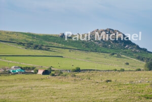
There is a Sharp Tor on Dartmoor. This one on Bodmin Moor rises to 378 metres. It’s a bit of a craggy climb up to the top, but you don’t need to – it’s not part of the route. On a clear day, without ascending the tor, there are magnificent views to take in from here.
Head east up the slope to the stones marking the cairns. From there head north once more down the gentle slopes. You will link up with a disused rail path. Head easterly along it until it links up with another path heading NE. Walk this for a short while before a branch off of it heads NW up and then around High Rock with Kilmar Tor high above.
Twelve Mens Moor
Just after the rail path runs out, walk northerly from High Rock. On the slopes here, it can be a bit tricky with no obvious path down. You have to clamber over the rocks, but watch out for the gaps and holes. Head down the more gentle slopes. Again, this is rather rugged terrain with many trip hazards.
Eventually, you’ll come to a bridleway. Head easterly along it. There are cairns, cists and, just before the path reaches the road, there is a settlement and an ancient field system. The route takes a southerly direction back up to the eastern flanks of Kilmar Tor. The start of the ascent is very boggy.
Kilmar Tor
Kilmar Tor is the highest point in the area at just under 400 metres. The route goes around its flanks, but you can climb it if you have time.
Just at the point where you are due east of Kilmar Tor, the route is SW. The grassy path you are on meets the disused rail path you left earlier. Just before that point, you need to leave again, but this time heading SE. Head towards Boundary Rock and the slopes of Bearah Tor.
Bearah Tor
Bearah Tor is at 367 meters. It comprises a working quarry at its east end. The route takes you to the west end with impressive granite formations.
From Bearah Tor, head south, down and then up the gentle slopes of Langstone Downs. The route continues to Sharp Tor once more. Continue walking south and down the steep slopes of Sharp Tor, onto the permissive path and back onto the Wardbrook Farm road.
The Railroad to Minions
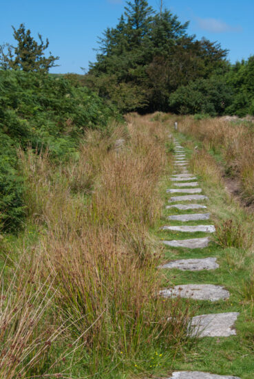
A short walk east along the farm road you’ll see a path split off to the right. This is the start of a long, disused rail path back into Minions. This path has well-preserved sections along it. You’ll see the granite sleeper stones. Other sections are not so good, but it’s fairly straight and level.
This railroad was part of the Liskeard to Caradon mineral transport system, built in the mid-1800s. Along the way, the railroad passes the impressive Pheonix United Mine workings on the left.
My traced route links up with the road leading from the Pheonix United Mine. It was getting dark, so I favoured the road. You can remain on the rail path back to the car park. You can also link up with the South Pheonix Mine Visitor Centre, which is near the car park.
This is a great area to walk around and explore. As I mentioned at the start, you don’t need to do the whole walk. Some parts are accessible to wheelchairs and pushchairs – the sorts with chunkier wheels for rugged terrains. The Hurlers, for example, are fairly accessible for those who struggle to walk – just 5 to 10 minutes from the car park. There are also stop-off places just before you reach Minions village to get a good sense of being on the open moor. It’s great for the mind and well-being.
If you have experience in this area or want to know more, leave a comment below.






Any chance of the GPX file for this walk? I can’t download it from your site directly.
Apologies for the delay in replying. Something has changed and I’m unsure if it’s my site’s software or the functionality of browsers. While I’m working on it, you can click the link to the GPX file, which will open a page of code. You can then right-mouse on that page and select Save As. In saving it, it will name it like ‘filename.gpx.txt’. You need to remove the .txt bit so it is like ‘filename.gpx’.
Thanks for letting me know – I had this working and I’m following recent instructions on how to form download links, but it ain’t working properly.
UPDATE: I have managed to sort the problem. It seems that modern browsers are hell-bent on opening and displaying file content rather than downloading them, so they have to be forced to download with a bit of web coding trickery.