Last Updated on 19th October 2023
If I’m walking around Looe, it’s usually a coastal walk along the South West Coast Path (SWCP). I recently stumbled on an article about the Giant’s Hedge which, naturally, got my attention. So, I plotted a trail to walk from Looe, along the West Looe river and the Giant’s Hedge. Then to Polperro, Talland Bay and back to Looe via the SWCP.
What is the Giant’s Hedge?
The Giant’s Hedge is a considerable man-made boundary that extends from the West Looe river to the RIver Leryn. Its purpose is not fully understood but is thought to have been excavated near the end of Roman times. It is a linear earthwork, creating a large hedge, or maybe a safe passage.
It might have been built to prevent marauders from the south and sea from stealing cattle. Another possibility is that it provided a safe passage for fishermen to travel overland between Looe and Falmouth (via Leryn).
This walk covers just the section within Kilminorth Woods, along the West Looe river.
The Looe, Giant’s Hedge, Polperro & Talland Route
The walk described here starts at Hannafore in West Looe. Being a circular route, you could join it anywhere and in either direction.
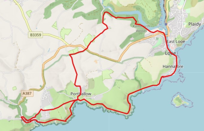
Download the map – this opens in a new tab from which you can right-click and save the image or print it.
You can download the GPX file for this Looe, Giant’s Hedge, Polperro and Talland route to overlay a map in your mapping app and device. Read my article, Top Tips: Mapping & GPS for Hiking.
The whole walk is 10.5 miles and will take 5 to 6 hours, allowing for refreshment breaks along the way. As you can see, there is a cross-over point at Talland. This enables the route to be shortened by turning east from Talland rather than continuing to Polperro. Although I wouldn’t want to cut off Polperro, it’s beautiful.
It is also possible to walk just a few miles by parking at Looe’s Mill Pool Car Park and taking a circular walk into Kilminorth Woods, along the Giant’s Hedge and the West Looe river. The paths and walkways are pretty good and a favourite for dog walkers.
If you are new to walking or hiking or simply want to get back into it, read my article, A Beginner’s Guide to Hiking and Long Walks.
Let’s get on with the walk, starting at Hannafore.
Hannafore Point, West Looe
A disclaimer before we start – at the height of the season, you may not be able to park along here. It’s not a problem, you can head to Mill Pool Car Park, but there will be a parking charge. So come prepared with cash, cards, etc.
When Looe is not so busy, the road to Hannafore Point hugs the coast and comes to an end at a gate. It’s often possible to park here, out of the way, along the coast side of the road.
I like to park here because the gate I mention above marks the end of the SWCP section. So, it’s off the SWCP, back in the car and done, with no need to walk through Looe looking all sweaty and muddy.
People ask: where does the Looe to Polperro walk start? Well, it starts in Looe but, from Hannafore Point, the gate I mention is also the start of the SWCP section for that walk. You can walk there and back, or maybe look for buses at Polperro. On with this walk…
From Hannafore Point, walk east along the road you drove along, all the way back to Looe Bridge. In West Looe’s Fore Street, along the way, there is a small grocery shop to pick up snacks and refreshments. There are some great sights along the way. Looe Island, of course, is unmissable just off the shore. As you turn north, the views into Looe, the beach, the river and Banjo Pier are amazing.
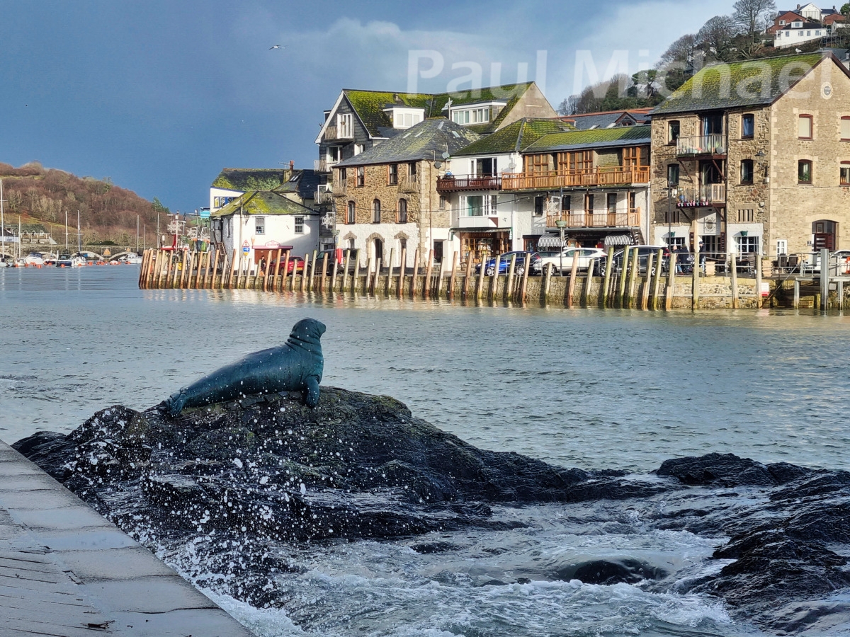
Looe Bridge was built in the 1850s and replaced the structure that was there from the 1500s. You could detour east over the bridge, into Looe, for snacks and refreshments, and back.
Cross over the bridge road to the amusement arcade building and the narrow walkway beside it. There are a few souvenir shops in this area to look in. Continue on to Mill Pool Car Park.
Mill Pool Car Park
As you walk into the car park, it heads west along the West Looe river. People ask: can you walk along the river Looe? You can walk from the beach at East Looe, or from Hannafore, on either side of the river Looe. However, Mill Pool is the point where the river Looe splits East and West.
The Mill Pool is seen ahead as you walk into the car park. It attracts model boat enthusiasts, and you can walk its perimeter path between the pool and the river. Watch out for high tides, the path gets flooded.
This is where you might start the walk if you can’t park at Hannafore or if you want to do a short walk through Kilminorth Woods.
Continue walking to the end of the car park. There is a slipway at the end.
Kilminorth Woods & The Giant’s Hedge
Just past the slipway, you’ll see the start of the woodland walk. You can walk east a short distance along a path and head into the woods to walk more of the Giant’s Hedge. Otherwise, you can do as I did and continue walking NW along the fairly well-made-up path. The Hedge is up and to the left and the river to the right – you get the best of both attractions.
I walked a little too far along and picked up a path down to a beachy area by the river. It’s just before the river bends to the west. I really must go back in the summer, it is beautiful with views up and down the forest-lined river. The colours would be much better in the summer months. I had to back up and walk up to the intended path again.
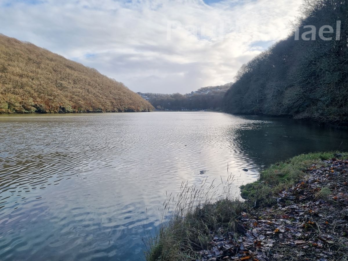
As the path changes westerly, it comes close to the Hedge. At this point, I took the path that hugs the Hedge.
To be honest, there isn’t much to see of the Hedge itself. It is more that the ridge that you are walking next to is the Hedge. It would have been an enormous effort and taken hundreds of men many years to excavate and build it up like this. Today, it is home to hundreds of trees, which do a good job of concealing it.
Watergate
There is a small hamlet in this area. If you are doing just the woodland walk, it’s time to head back. You can go back the same way, or pick up one of the other paths to get you back to the car park.
The route onwards sweeps around in a southerly direction. As you come out of the woods, merge into the lane. If you go too far in the woods, you’ll link up, lower down, with same the lane. Head south.
Continue a short way where the lane veers SE and then, at Kilminore, turns SW.
A little further on again, at the junction, continue straight on along the narrow path.
Oaklands Holiday Park
The narrow path leads to Oaklands Holiday Park. This was my first visit to this Park. Although it was mid-winter, it looks like a lovely, well-presented and relaxing holiday park.
Keep to the main paths to walk out through the main coast road entrance. Continue across the road along a westerly lane. Just past West Wayland Touring Site on the right, at the junction, turn left, heading south for about a quarter of a mile.
The lane sweeps left (there is a path to the right), and to the right as it heads down past the Talland Bay Hotel.
Talland Bay
The area is Porthallow and Talland. The scene is a rugged bay of rocks with two small beach areas. There are toilets and refreshments from the hotel and a couple of cafes. The Talland Bay Beach Cafe is located at the bottom of the lane that you are on.
At this point, you can walk onto Polperro or turn back to Looe for the shorter walk (around 7.5 miles in total). See the section below, Talland Bay Again, to get directions back to Looe.
Onto Polperro, I can only apologise, as this section takes the westerly lane up from Talland. When I say ‘up’, I mean UP! Sand Hill is straight and very steep. The last time I was here, there was a lorry stopped at the bottom of the lane. I could barely get around it. I then realised it was stuck there. Maybe the driver thought the lane linked up with the road I had just walked down into Talland Bay.
Continue walking up and up. As the lane evens, continue on past the school and then turn left heading down to Polperro.
Polperro
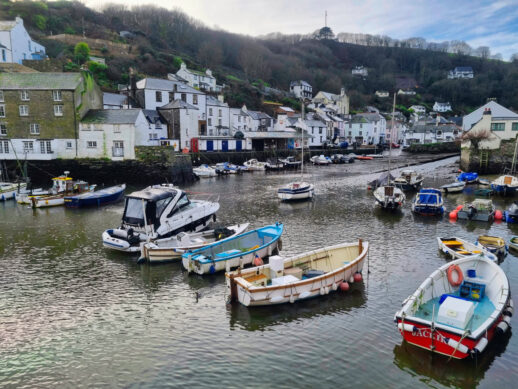
This is one of my favourite Cornish coastal villages. As you come down the hill, you’ll see why. Lots of quaint cottages, all shapes and sizes in various pastel shades. The lane down, Talland Hill, is steep, and you can see over the rooftops of some cottages, and glimpses of the pretty harbour through the gaps of others.
You’ll notice some cottages with a horizontal linear rendering pattern. Locally, it’s become known as a ‘Polperro Ripple’ and is quite common here and in neighbouring towns and villages.
Then, near the bottom, the lane levels out with shops, restaurants, and art galleries. When you turn the corner by the Post Office, you get to see the harbour in all its glory. It’s such an iconic place.
This is where my timing always goes to pot. I love wandering around the village. As well as narrow cobbled alleys with souvenir and gift shops, there are a few pubs and, as mentioned, various eateries. I like to buy sandwiches and refreshments locally and find a bench to watch over the harbour. Watch out for the seagulls though! They are skilled in grabbing chips, pasties and anything edible right out of your hand. The tactic is to stare them out as they come close.
Walk to the other side of the harbour to walk its length and out to the harbour wall. There are some great views looking back into Polperro and out to sea, and also the disused cottage on the rocks.
Polperro History
Polperro is a traditional fishing village and it is still a working harbour. The nets, buoys, and lobster pots you see stacked up here and there are very much in use, and not just for effect.
The village has a long and rich history, dating back to medieval times. It was originally a fishing settlement, and its first known record is in a Royal document of 1303. Polperro also has a rich smuggling history, which is thought to have prospered from as early as the twelfth century.
In the 19th century, Polperro became a popular tourist destination. This was due in part to its picturesque setting, but also to the fact that it was one of the few places in Cornwall that was not affected by the Industrial Revolution.
Walk back around the harbour and head up Talland Hill again, but fork right along the lane on the north side of the harbour. Continue up the lane as it merges onto the SWCP.
Just before it merges there is another path down to Spy Point. It’s a great vantage spot for photos.
SWCP to Talland Bay
I like to save the best bit until last, so getting onto the SWCP is my idea of a great homeward-bound stretch of a walk. My camera is back out of the bag with endless, it seems, opportunities for photos.
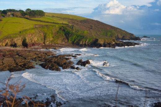
After the steep ascent, the path levels out somewhat and is a fairly easy-going walk back to Talland. The path hugs the coastal cliffs and you’ll see beautiful beach coves and amazing rock formations. There’s plenty of wildlife too with many sea birds.
The path is about a mile and sweeps out around a headland before heading into Talland. The approach back into Talland is much easier than the lane used to get to Polperro.
Talland Bay Again
Back at Talland Bay.
Talland Bay is a great place to relax and enjoy the natural beauty of Cornwall. As you walk in from the coast path you can see why it is so attractive. The two little beaches are great for swimming, sunbathing, and playing in the sand. The coastal cliffs around it offer stunning views, and the coves are perfect for exploring.
Walk along the road to the furthest small beach. The SWCP is off to the right.
SWCP to Hannafore, Looe
How far is Talland Bay from Polperro? The final stretch is about 2.5 miles of coast path. It’s steep in places with steps. Don’t let this put you off, it isn’t a race and you can do what I often do – stop and pretend you are taking in the view while having a breather. Also, uphill give way to downhill walkers in my rule book. That way, the uphill walker gets a breather.
A little way along the path you come to Portnadler Bay, a long curve of shingle beach. There’s a short, steep path down to it at the east end of the Bay. Not a bad spot for a dip if you have time. Note: there are no lifeguards and you may be alone.
Continue on, up and down the hills and steps, and the path becomes easier and more level in the final mile.
St. Michael of Lammana
Near where the SWCP ends at the gate at Hannafore Point, there is an important archaeological site up the grassy slopes. These are the remains of the chapel of St. Michael of Lammana. It is said that Jesus and his father, Joseph, once visited Looe Island, or Lammana as it was once known. Apparently, this was to trade for tin, which would have been used for bronze and was plentiful in Cornwall. I thought Joseph worked with wood, but what do I know?
The story stuck and pilgrims came from far and wide to visit the island. However, rough weather meant no crossing and the pilgrims were always on the lookout for temporary shelter. So, a priory was built on the mainland to give the pilgrims shelter and food. Today, you can see just the foundations from when it was demolished during the reformation of the 1500s.
Walk on just a couple of hundred metres to the gate at the end of the SWCP to arrive back at Hannafore Point.
Take a Holiday in Looe or Polperro
If you are not local to this area, I hope this guided walk has inspired you to take a holiday in the area. There are many places to stay with holiday parks, hotels, guest houses and rentals. Take a look at this list of hotels and holiday properties in Looe, Polperro and the surrounding area.
While you are relaxing on the terrace or the beach, read a book or two on Looe and Polperro to plan more walks and excursions, or simply to soak up the ambience.
Thanks for reading this guided walk of Looe, the Giant’s Hedge, Polperro and Talland. Please leave your comments below.

