Last Updated on 19th October 2023
It’s Sunday, early August 2020. The sun is up and my son and his partner are excited to be up early to travel to Bude. They will be surfing the seas. I will be walking the canals and the South West Coast Path on a 12.5-mile circular walk. The route is clockwise from Bude, along its canal to Widemouth Sand to Sandymouth Beach, and back to Bude.
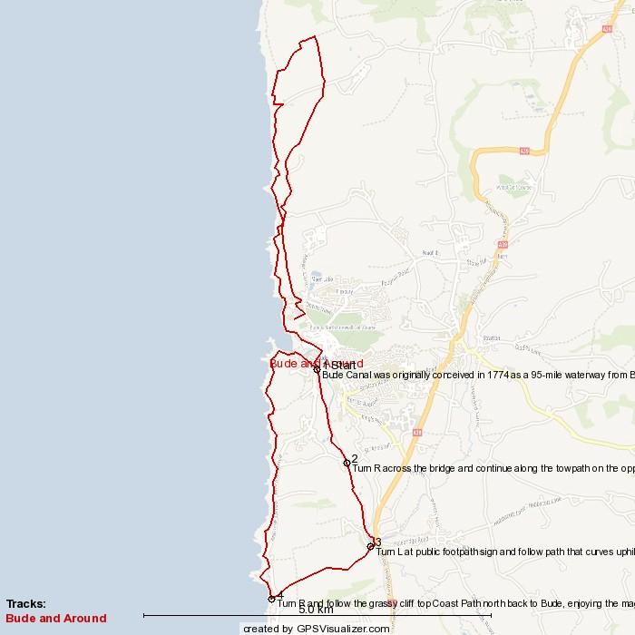
The route is a figure of eight with Bude at its centre. This means that this could easily be taken as two or more shorter walks. It’s also worth thinking about the direction of travel. Where I go clockwise, the opposite may be better for you to match meal times and food outlets.
Here is the GPX file for download, complete with any meandering off-course for anything that got my attention. For more information on how to use GPX files for walking, read my article: Top Tips: Mapping & GPS for Hiking.
Take a look at these great maps and books for walks around Bude.
Bude
I think I last visited as a child, but from the short time I spent walking out of Bude to get on my route, I could see it is a lovely seaside town. No wonder so many people flock to it. In its bustling centre, there is a great range of shops, restaurants, cafes and pubs to suit all tastes. There are lots of interesting buildings and displays on the outskirts of town, along with the river and, of course, the beach.
I was so impressed that I was back there within a month with my wife for a good look around the town and a walk down the canal.
Bude would make a great short break or holiday destination. It’s on the border with Devon and Cornwall, so would be a good base to explore the delights and attractions of the surrounding area. Here is a list of hotels and holiday properties in and around Bude.
The Bude & Canal, Widemouth and Sandymouth Circular Walk
Bude and the Canal
We got into Bude at 10.30 am, and the main beach car park was filling up fast. It’s not surprising as it was the school holidays. We parked up and they took to the beach. I headed off back through the town towards a bridge that goes over the river Neet and then, through a gate, to pick up with the Bude Canal toe-path.
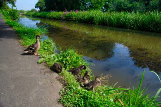
Yes, Bude has a canal. It was originally built to transport lime-rich sand inland to use as fertiliser on the fields. It was opened in 1823 and rose from sea level up to 132 metres. Today, it’s a lovely family walk with ducks, swans and even the odd heron. There are most likely more bird breeds if you care to sit in the bird look-out that was built for a local airforce chappy who loved all things that fly. It looks over Bude Marshes, a nature reserve that looks very tranquil.
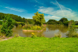
Further down the canal, cross over the bridge. About 400 metres further on is the first lock. There are two on this route. Then, further on again, there is a fishing lake on the right. The route goes around the lake and then, to its south, onto a public footpath, heading southwest up over the fields and then down, across the coast road onto an area marked as Salthouse.
Widemouth Sand to Bude
Just a short way south of Salthouse is Widemouth Sand, a long stretch of golden sand that faces east – wonderful for surfers. You can walk further on to Widemouth but I opted for a short stop for a flask of coffee and a biscuit.
Walking tip: I love coffee, but I find that coffee shop stops take too long when I’m on a fairly tight schedule. Their take-out cups tend to be a bit bulky. So instead I either make my own or ask a coffee shop to fill my flask. Mine fits into the side of my backpack and keeps the contents hot enough until mid-afternoon. I can also choose my own beauty spot along the route to drink it. Here are some walker’s flasks examples from Amazon.
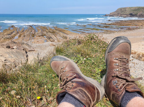
Walk north along the coast path. This is a beautiful stretch of coastline, not too hilly, yet so much to admire. The rocks along the beaches run in unusual streaks – some in herringbone patterns.
The cliff path ascends and, as it gets higher, a distant satellite station will come into view. It’s known as GCHQ Bude on some maps or, simply, Radio Station, on Ordnance Survey.
Further up the coast, there is Efford Beacon. Further on again, the Storm Tower (Compass Point on the map) is positioned very prominently just before the coast path changes northeast and then around and back into Bude.
As the path comes into Bude it once again links up with the canal – at its source this time with a huge lock gate that, once opened, leads out to sea.
This completes one half of the circular walk, should you opt to do this section on its own.
After a short stroll along the toe path, I came across the Lock Gate Tea Room. I settled for a takeaway Cornish pasty, of course, and a cold drink. I headed off to a patch of inviting greenery where I sat and watched people having fun on the pedaloes and rowing boats. By the way, it was a rather nice pasty.
Bude to Sandymouth
Off on the way again on the second part of the walk, heading north. Again, this section can be done on its own as a shorter walk.
Pick up with the coast road that goes past Sainsbury’s and another large car park. Turn right and head east for 100 metres and then left and up the hill, walking past Crooklets to the left.
The road carries on and, eventually, becomes more of a path. At a place marked as The Bungalow, the path briefly merges with the coast path. It then takes the east side of Bucket Hill.
The path undulates and, when it reaches the higher points, again, the satellite station pops up ahead.
The path leads into a field at Sarshall’s Pit. I was surprised to see lots of campers pitched up with tents and camper vans. Aside from a portaloo, There were quite a lot of campers, so they must have been enjoying the rather rustic site with magnificent views over the coast.
Eventually, the path leads out onto a road. Turn left to head down to Sandymouth. This is a popular spot. There’s a car park in a field just before it joins the road, plus another National Trust car park down the road by the beach. As I walked down, late afternoon, many people were making their weary way up the steep road, packed with their beach equipment and kids. It was a very hot day. I guess many of them would have been heading back to the Sandymouth Holiday Resort, a bit further up the hill from where this route joins it. I must check it out, as this area would be a great place for a short break or holiday.
Sandymouth to Bude
Near the bottom of the road, pick up with the coast path heading south and, yes, it heads up a steep gradient as it rises up the cliffs. As they say, what goes down, has to come back up, or is it the other way around? Once again, the fantastic vistas of sheer cliff faces and lively waters come into view.
The coast path basically goes back opposite to the northbound route but on the opposite and more scenic side of the Manachurch Point and Maer Down fields.
Finally, the coast path nears Bude and the Bude Sea Pool – a swimming pool built into a natural rock cove on the Bude Haven beach. It looked very inviting.
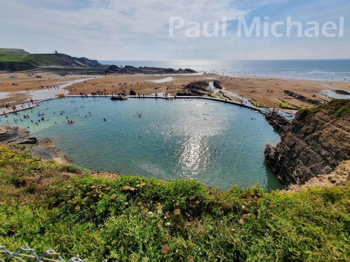
I was back in Bude. Just in time to get a text from my son to say he’s returned the surfboard he had hired – he had to return it by 5 pm – and he and his partner were waiting by the car, ready for home.
It was a fantastic day, and Bude is well worth a visit. It was much more vibrant and scenic than I imagined. The scenery out on the canal and coast paths is stunning.
If you would like to get into walking, read my article: A Beginner’s Guide to Hiking and Walks. There are many health benefits and, like me, you can fill your device with lots of lovely photos.
Thanks for reading this. If you have visited or walked Bude, Widemouth Sand or Sandy Mouth Beach, add your comments below.

