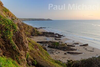
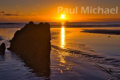
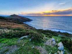
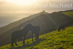
Whitsand Bay in SE Cornwall is an astounding stretch of coastline and beaches, enjoyed by thousands of visitors all year round. Yet, many visitors to the area simply drive by and miss the opportunity to see and experience its delights.
I have lived in this area for most of my life. As a child, I would holiday with my family in a chalet on the Freathy cliff. In my young adult years, the beaches along this coastline were visited frequently with friends. As an older adult, I have stomped many miles of walking along the Whitsand Bay cliff road and footpaths.
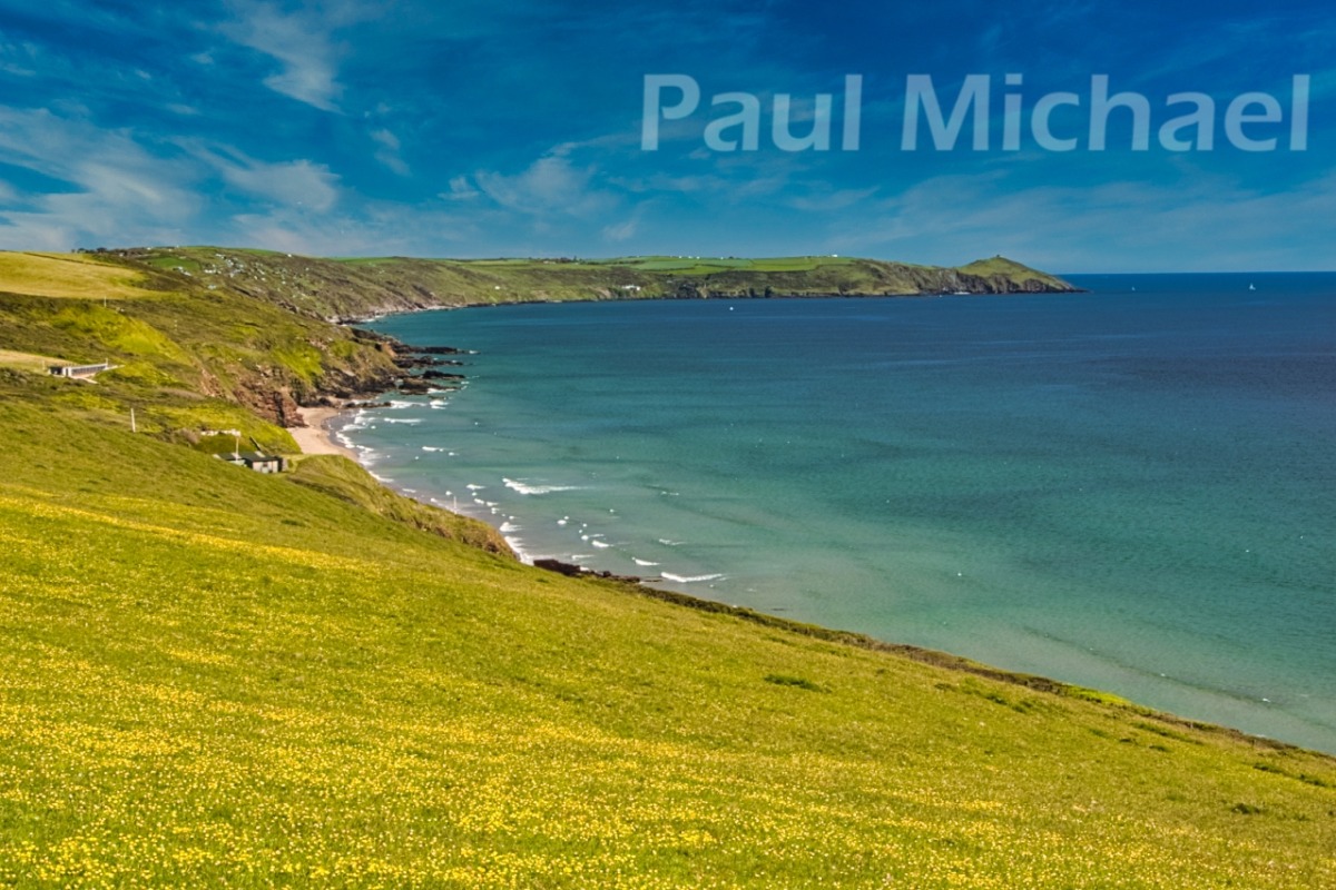
Where is Whitsand Bay
It’s a Cornish secret, I’m not telling you!
Oh, OK then…
The Bay stretches from Portwrinkle in the west to Rame Head in the east. From Portwrinkle, the coast road heads up to Crafthole village and along to the junction at Tregantle Fort. Military Road (known locally as the cliff road) hugs the cliff tops from Tregantle Fort all the way to Polhawn Cove before heading inland. Rame Church and Rame Head (and the car park) can be accessed from further down and along Military Road before It continues further to Penlee Battery.
For me, the best way to cover Whitsand Bay is on foot. The South West Coast Path hugs the coast from Portwrinkle to Rame Head. There are sections that divert onto the cliff road. There are other sections that offer the choice of the SWCP or the road, which is good when it is particularly boggy. Also, Tregantle Fort and the land and seas around it is a designated military firing region. The route is by road on firing days, although I haven’t yet been affected by this.
Read my article, Walking from St Germans in SE Cornwall, to find out about my local walking routes for this area.
On spring low tides it is possible to walk or run the 3.5 miles from Portwrinkle to Polhawn along the beach. Make sure you get your tides right though!
Whitsand Bay Beaches
The predominant splendour of Whitsand Bay is the golden sands that can be seen stretching for miles, especially on low tides. This is what most visitors flock to experience – both local and holiday folk. However, it is clearly Tregantle Beach that gets the most visitors. On sunny summer days, the coast road and nearby car park at Tregantle are rammed with parked cars. Military Road is a clearway from 1st April to 30th September – no stopping or parking on the road. The traffic wardens have a field-day slapping tickets on cars parked where or how they ought not to. You have been warned.
I’m always amazed that people bundle to Tregantle, and not to the many other beaches further along the Bay. All of them are beautiful and practical in their own way. If it’s for the sun and sea worshippers, all of the beaches can provide for them. Some beaches are better for young families, though, with things like rocks to clamber over and rockpools to keep young children occupied.
Safety is also important and, during the summer seasons, many of the beaches are attended by the RNLI Lifeguards, but not all.
Some beaches have facilities – toilets and refreshments – while others, including Tregantle, are very limited and may have nothing at all in winter months.
Accessibility
Sadly, most of the beaches are inaccessible to wheelchair users. The paths and steps to the beaches are steep, narrow and sometimes precarious. Many able-bodied people will find them a struggle. You can get very close to the beach at Portwrinkle Harbour with its gentle slope down. There are some accessible cafes and stopping points (laybys) along Whitsand Bay from where you can enjoy the views and sea air. When I am walking high up along the cliffs, the views and smell of the sea dramatically change my mood. There is now much talk of this being great for our mental well-being.
Portwrinkle
At the most westerly point is Portwrinkle, so named, it is said because ship navigators saw a port on the fold or wrinkle of their nautical maps back in the day.
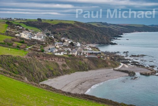
The village comprises two beaches – Portwrinkle and Finnygook – along with a small harbour. There is a cafe and public toilets, along with a pay & display car park. There are no RNLI Lifeguards in operation on these beaches. Portwrinkle is also home to Whitsand Bay Golf Club.
The furthest west is what I know as Portwrinkle Beach. It’s not named on OS maps and perhaps the villagers know it by a different name. It is accessed along the coast road from the car park and down the slope at the harbour. The beach is a curved cove of fine shale with relatively safe bathing waters between the submerged rocks. The harbour entrance often attracts bathers where a pool of water is formed at mid-tides. A few SUP/paddle-boarders use this beach on calmer days.
Finnygook Beach has its pathway just to the east of the car park. It’s a short walk down, and not too bad getting back up. It is a sandy beach with a nice bathing opening between the rocky parts of the beach on the left and right.
I love the rocks along the length of this beach that extend to the harbour on safer lower tides. My family has spent many hours rock climbing and exploring rock pools all along.
There are lots of holiday properties Portwrinkle, as well as being home to local residents. Crafthole, about a mile up the road, also caters for holiday folk. Here is a list of holiday properties in the Crafthole, Portwrinkle and surrounding areas.
Long Sands
As the name suggests, Long Sands is a long beach of golden sands. On a spring low tide, it is possible to clamber over the rocks from Finnygook Beach but, be warned, the tide can quickly cut off the route back. It is also accessible from Tregantle.
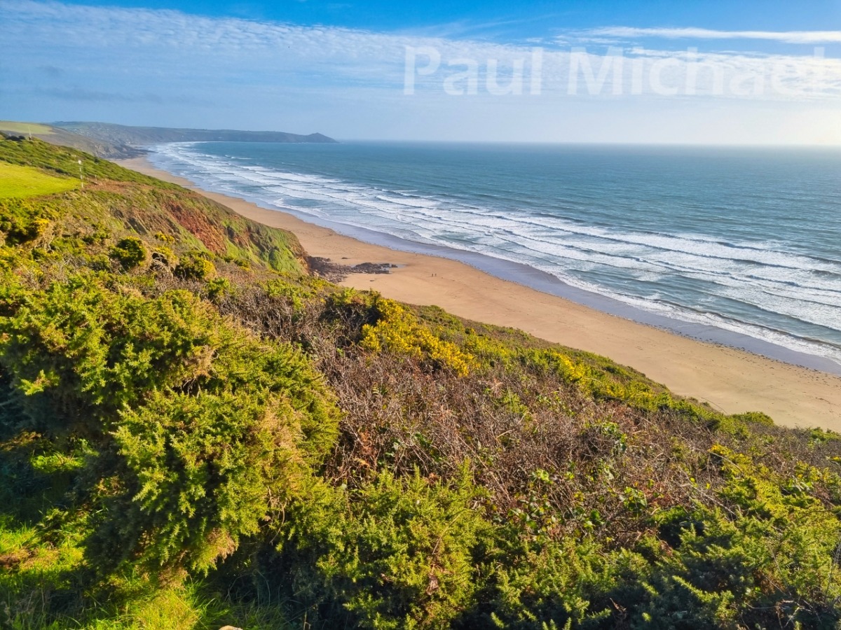
The tide rises up the shore to form many small coves when it meets the cliff edge along its length. So, be very careful where you settle along this beach, as you may get cut off completely for several hours.
Tregantle Beach
Long Sands merges into Tregantle Beach below the western end of Tregantle Fort. It extends to below the bend in the Military road. When the tide is high, there isn’t much beach. The best time to visit is at an outgoing mid-morning mid-tide when you get the best part of the beach for the best part of the day. Although, this could be said for most beaches.
There is a free car park near the junction with Military Road. You could join the hoards of other people who try their damnedest to squeeze their car into somewhere on the side of the road. The car park is an extra 50m away on levelish ground. Well, more level than the long, steep path you will walk down, and then back up at the end of the day.
Aside from, maybe, an ice cream van or coffee vendor, the facilities are limited to a porta-loo at road level (sometimes) at Tregantle. The beach is manned by RNLI Lifeguards in the summer seasons.
Sharrow Beach
The RNLI also man Sharrow Beach, known locally as Grotto Beach. The Freathy pay & display car park is along the cliff road on the left. You can pay by coins and it looks like you can pay with mobile phone (no app mentioned). The facilities are limited to a porta-loo. Now the car park is chargeable from 9am to 5pm, it puts off the ice cream van and other vendors.
Cross the road from the car park and head down a rocky path to the Grotto on the slopes of Sharrow Point. This shallow cave (now with a fenced-off entrance) was carved out of the rock by Lugger, as told in this article about the Grotto at Sharrow Point.
The walk down to this beach is a bit of an adventure and probably best not ventured with very young children. Basically, heading down the rock on Sharrow Point, you go back on yourself around to the right, following a carved-out path and steps down the rock to the beach. This inaccessibility makes it a firm favourite for able-bodied locals.
Golden sands, interesting large rock formations, sun (sometimes) and sea, it’s gorgeous!
Freathy Beach
The next beach along from Sharrow is Freathy, which lies below Freathy cliffs and what must be now classed as a small village of chalets. There are two points of access to the beach. The first is as for Sharrow, but you turn left above the Grotto on the cliff path down to the beach. The other way is to walk from the car park along the SWCP and, when it links back up with the cliff road, walk around to the right. There is a path on the right that winds its way down through the chalets to the beach.
Freathy Beach has all the wonderful qualities of Sharrow but, sadly, there are no facilities anymore. There used to be a tea room, but that looks to be an AirBnB now. There also used to be a small shop up amongst the chalets above the cliff road but seemingly it has gone now too.
The beach is manned by RNLI Lifeguards during the summer seasons.
Withnoe Beach
Freathy Beach continues onto Withnoe Beach at mid-tides and lower. The theme of golden sands and interesting rock formations continues along here.
There is a car park on the cliff road marked as Whitsands Beach Car Park at the junction of Cliff Lane. I think this is a summer seasonal person in a field business. There will likely be laybys to park out of season in this area. Opposite the junction to Cliff Lane, there is a path down to the beach.
There are no facilities specifically for Withnoe Beach, but read on…
Tregonhawke Beach
Withnoe Beach merges into Tregonhawke Beach and can appear as one. However, Tregonkawke has its own access route from the cliff road opposite the junction of Donkey Lane and the Holiday Park, plus another path a little further west. I wish there were more parking facilities in this area. There are laybys, but these get used up quickly on nicer summer days.
These two access routes converge at the Cliff Top Cafe. I often drop in here on my longer walks for a coffee and, of course, some cake or, sometimes, a bigger eat. There are toilets.
Tregonhawke is one of my favourite beaches in the Bay. I spent so much time here when we were a younger family. My son got into surfing and Tregoonhawke is the home of the Whitsand Bay Surf Lifesaving Club. This is an amazing organisation that arranges beach and water activities through the summer seasons. It’s aimed at kids, teaching them how to act and be safe in the water.
Adventure Bay Surf School runs a number of activities including, of course, surf lessons, but also surf hire, paddleboarding and coasteering, So if you fancy having a go, look them up.
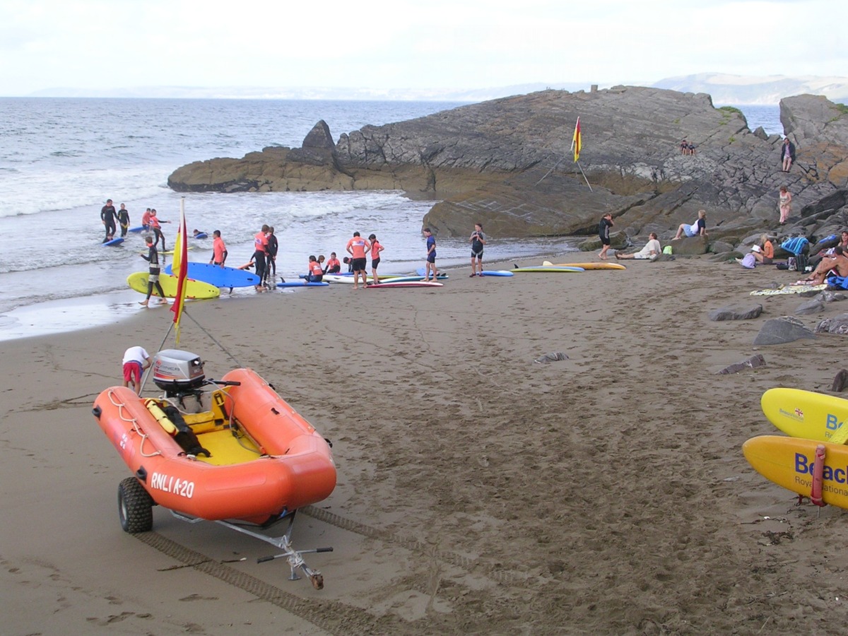
The RNLI Lifeguards are active here in the summer seasons. They cater for Tregonkawke and Withnoe beaches.
The Eddystone Cafe is practically on the beach and is open during the summer season. They serve food and refreshments and have a toilet. They also have a couple of holiday apartments.
This is a great beach for younger families. Although the path is steep and rather a long haul back up to the road at the end of a great day, it is fairly accessible. There’s also ice cream near the top.
Wiggle to Polhawn
Tregonhawke extends east beyond Ninney Rock to Wiggle Cliff. From here on there are more rock formations than sandy beaches. There are a few coves that can be accessed along the beach from Tregonhawke or, quite popular, by boat. I often see small boats and yachts moored up in Polhawn Bay. They row their tenders to Polhawn Cove, which lies below Polhawn Fort.
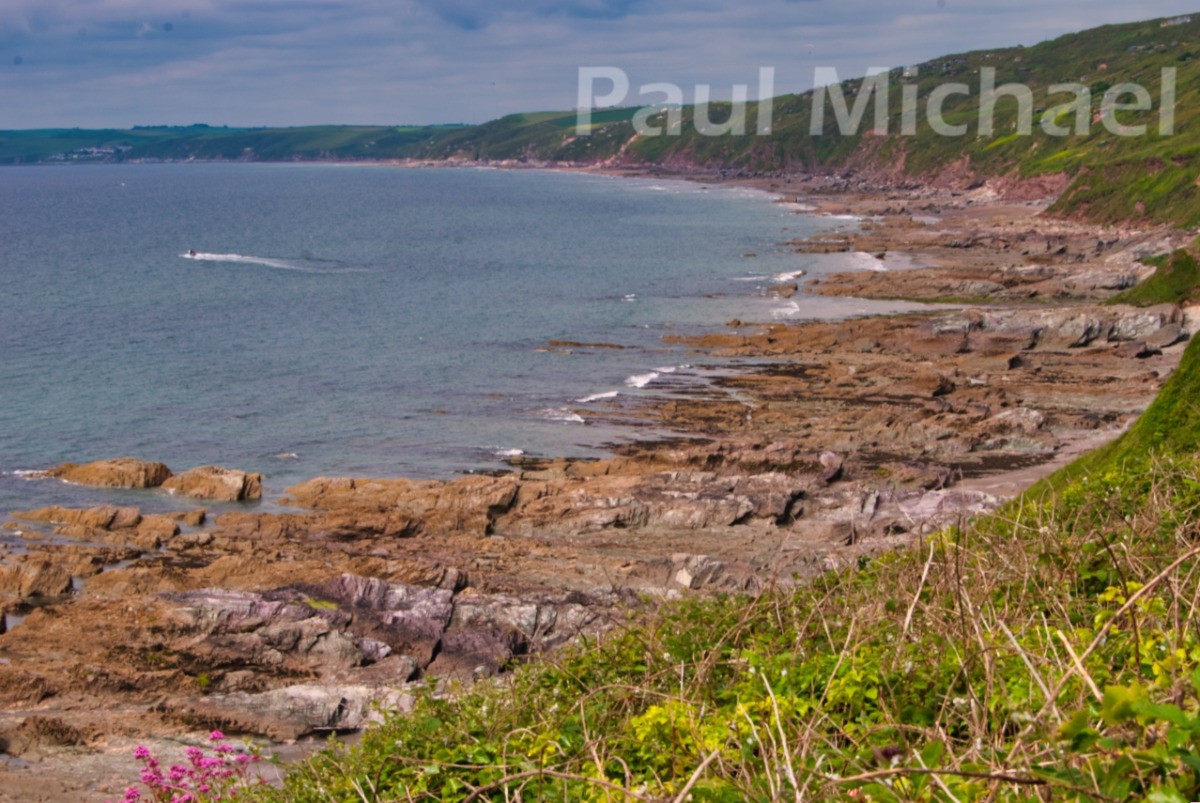
This stretch of Whitsand Bay, also known as Captain Blake’s Point, is very wild and rugged at shore level. I can’t find any references to Captain Blake. Yet, the holiday camp atop Tregonhawke was once named Blake’s.
There are no facilities at this end of the Bay. The tides can cut you off completely and, be warned, there is very little beach left at high tide.
There are some fantastic holiday properties perched along the cliffs here. I am particularly envious of what is now called Captain Blake’s Retreat. The SWCP goes right by this stone-built chalet that stood derelict for as long as I can remember. Then I saw the path to it being widened and stabilised, and the chalet being renovated. I imagine that the views and sounds of the sea from here would be absolutely amazing.
Rame Head
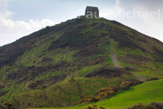
The most easterly point of Whitsand Bay is Rame Head. It is a pyramidal-shaped headland with a small disused chapel at its top that can be seen for miles around.
There is a pay & display car park that appears to charge from the 1st May, and is run by Mount Edgcumbe Park.
This is a beautiful area to walk around, visit the chapel and take in the views both east and west. To the east side, there are often wild ponies along the coast path. The coastguard station takes up a prominent position beside the car park.
Read my article, A Jaunt Around Rame Head, for a short walk and more details of this area.
Whitsand Bay as a Holiday Destination
Whitsand Bay and SE Cornwall has so much to offer for a short break or a longer holiday. Whether it’s buckets and spades down on the beach, or a walk in Mount Edgcumbe Park. Maybe a trip to the coastal villages and towns, like Kingsand, Cawsand, Downderry, Seaton, Looe or Polperro. There is also Minions on the SE corner of Bodmin Moor. This would be a great base to experience the area.
Here is a list of hotels and holiday properties in Kingsand and Cawsand along with the Whitsand Bay area.
Take a look at these books on South East Cornwall.
Thank you for reading this article. If you have any experience of this area, please add your comments below.

